The Great Bindon Landslide, 1839-1840
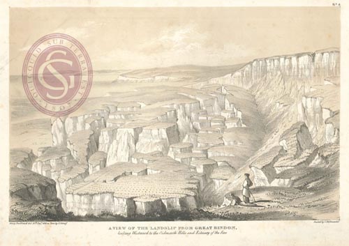 |
Tinted lithograph, 'View of the landslip from Great Bindon', Dorset, 1840. Delineated by Mary Buckland, 30 December 1839, on zinc by George Scharf. Printed by Charles Hullmandel. (ref: LDGSL/56/1/6)
The Axmouth-Lyme Regis stretch of the south coast of England comprises one of the best known areas of landslipping in Great Britain. It includes the site of the first large-scale landslide ever to have been the subject of detailed scientific description by geologists: the Great Bindon Landslide, 1839-1840.
William Buckland and his wife were quickly on the spot, “and while the Professor made careful investigations into the cause of the catastrophe, his wife, with her clever pencil, made a series of careful drawings of this phenomenon....” The results were published in Buckland’s and William Daniel Conybeare’s work, 'Ten plates comprising a plan, sections, and views, representing the changes produced on the coast of East Devon, between Axmouth and Lyme Regis by the subsidence of the land and elevation of the bottom of the sea, on the 26th December, 1839, and 3rd of February, 1840'. London: John Murray, 1840.