Product has been added to the basket

Harappan collapse

Sunset over the Indus River at Sukkur, northern Sindh Province.

The fall of the Harappan Civilization has been associated with rapid weakening of summer monsoon rains. New work now shows that changing river patterns may also have played an important part in their demise. Peter Clift* reports.


Geoscientist 19.9 September 2009


Throughout history human societies have prospered or failed, not only because of their relationships to other cultures, but also because of environmental conditions affecting a range of key issues, including agriculture and drinking water supply. Periods of rapid climate change are particularly dangerous, as existing communities struggle to adjust to new conditions. Studying cultural decline in periods of climate change past, should help us plan for our own uncertain future.

No period is better for illustrating the interrelationship of environment and culture than the Late Neolithic, when the Indus, Akkadian, and Longshan civilisations all appear to have experienced a major shift in the way they lived. The Indus Valley, or “Harappan” civilisation (see Box) was one of the earliest advanced urban cultures known to archaeology - and appears to have collapsed around 2000 BCE.

Map showing the map sites and features covered in this study.

Earlier palaeoclimate work has suggested a link between the end of settlement in major urban centres and a rapid weakening of summer monsoon rains. However, life may prosper in arid environments as long as it can be sustained by large river systems. The Leverhulme Trust has therefore funded a new study involving a diverse international group of scientists to explore the role that drainage reorganisation in the Indus Valley may have had on societal change at that time.

Sir Marc Aurel Stein at his tent in 1929 in central Asia during his many expeditions concerning the archaeological history around the periphery of British India.Our campaign of trenching and drilling across the flood plain of the Indus River system in western India and Pakistan is beginning to quantify, for the first time, how the Indus River and its major tributaries have changed over the last 8000 years - a period when summer monsoon rains were stronger than they are today. Although sedimentation continues to be active in the lower reaches of the river system, the new data show a cessation in sediment deposition in the north as the monsoon weakened and the supply of sediment from the Himalaya reduced. Provisional age data now show that between 2000 and 3000 BCE, flow along a presently dried-up course known as the Ghaggur-Hakkra River ceased, probably driven by the weakening monsoon and possibly also because of headwater capture into the adjacent Yamuna and Sutlej Rivers.

The possible impact of drainage reorganisation on early cultures in South Asia has long been a matter of debate, but has been consistently hampered by a lack of hard data. Major river reorganisation causes many problems for civilisations - as can be recognised in the repeated changes in course of the Yellow River in China over the past 1000 years, and the subsequent displacement of populations. More recently, the Kosi River floods of Nepal and India in summer 2008, caused massive disruption.

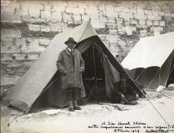
Abandoned former courses of the River Indus have also long been recognised, in the form of dried-up river channels along the edge of the Thar Desert. These were observed as long ago as the 1920s and 30s, in the work of Sir Marc Aurel Stein. More recently, they have been mapped in great detail using aerial and satellite images, and it has been possible to delineate the course of a now defunct “Ghaggur-Hakkra” River, which once ran from the Himalayas, between the Sutlej and the Yamuna Rivers. This palaeo-river was well positioned to have sustained the Harappan civilisation; though the age of water flow, and the patterns of interconnection between channels (and to the Indus itself) have remained speculative.
Drilling rig operated by the Geological Survey of Pakistan drills the flood plain of the Indus at Thatta, close to the modern river mouth.

Drilling


Following drilling in the Indus Delta by myself, Liviu Giosan (Woods Hole Oceanographic Institution) and Ali Tabrez (Pakistani National Institute of Oceanography) it has become clear that since the Last Glacial Maximum (around 20,000 years ago) the Indus experienced great changes in the composition and volume of sediment flowing through its channels. These changes appear to be linked to the changing strength of the summer monsoon rains.

Building on this earlier study, Clift and Giosan, together with Mark Macklin (Abersytwyth University) have initiated a new project to constrain how the river has evolved since the middle Holocene, ~5000 BCE. In 2008 Anwar Alizai and Sam VanLaningham (University of Aberdeen) undertook the first field excavations on the floodplain in the Pakistani state of Punjab, where the supposed Ghaggur-Hakkra River used to flow.

Using mechanical diggers (and local workmen where these were not available) they dug trenches into the deposits of the Holocene outwash plain. Targeting the channels themselves was hard, even with the aid of high-resolution satellite images. But in the end they were able to sample the flood plains of the palaeo-rivers, which allowed the team to start narrowing down when the river was flowing, and where its sediments were coming from.

Dates of sedimentation were obtained by radiocarbon dating freshwater gastropod shells and woody material recovered from the pits. Together, these showed that active river-flow along the Ghaggur-Hakkra had finished before 2000 BCE, at least in that region. New optically stimulated luminescence (OSL) ages, which measure the time since sediment was last exposed to sunlight (produced by Geoff Duller, Helen Roberts and Julie Durcan at Aberystwyth) support this general scenario.


Ali Tabrez assists Anwar Alizai in collecting sand samples for OSL dating from a bed underlying modern active dunes in Punjab.

Today, the Ghaggur in India is a very small river, within a modest mountain catchment. How could it once have been a much larger stream? We believe it is possible that the river was once swelled by other headwater catchments that are now diverted into other directions. The neighbouring Yamuna and Sutlej Rivers are the most likely candidates for this, and could well have been captured from the Ghaggur during the Holocene. If either or both of these streams formerly flowed into the Ghaggur channel then the river could have been very much larger than it appears today.

It is clear that the Indus has experienced major changes since the mid Holocene, when the whole system appears to have been in active deposition. However, since that time the northern reaches of the Indus and its various major tributaries have incised river valleys 20–30 m deep. What caused this change in behaviour? A number of possibilities are presently in contention.

While delta drilling proved that the early Holocene (11,000 – 8000ka) was a time of very rapid sediment flux, probably driven by fast erosion under the influence of a strong summer monsoon, the period since 8000 years ago has been one of weakening rains and reduced sediment flux, as established from lake sediment records in India and in cave records from Oman. In this case, the river may be “cannibalising” itself in its upper reaches, reworking the older floodplain sediments over which it is now flowing.

In order to reconstruct what the river system looked like at any given time in the past we have to know the provenance of the sediments in its overbank deposits. This can tell us how each tributary was connected to its neighbours and indeed to the trunk stream itself. In this respect the Indus is a great system for geologists because it receives sediment from several sources, with each characterised by quite different geochemical characteristics and ages.


Zircon to the rescue

The western Himalaya are especially heterogeneous with respect to the U-Pb age of zircon grains. Grains from the Lesser and Greater Himalayan Range display old zircon ages of around 400 Ma, 1000 Ma and 1800 Ma and older, whereas the Karakoram and Kohistan typically display ages younger than 250Ma - representing Andean-style magmatism along the southern edge of Asia, prior to its collision with India. This makes changes in large-scale drainage or erosion patterns easy to spot.

New technology (see Box) now allows large numbers of single grains to be analysed quite rapidly. U-Pb dating of zircon grains tells us when each grain cooled below 750?C (i.e. the age of its crystallisation from its source magma). The Laser Ablation Inductively Coupled Plasma Mass Spectrometer (LA-ICP-MS) at University College, London, now allows around 100 such grains to be dated every day. Such large numbers are needed for each sample in order to generate statistically reliable data sets.

Andrew Carter who runs this operation has shown that grains younger than ~250 Ma are unique to the main Indus River, whereas the major tributaries of the Indus that join from the east are dominated by much older grains sourced from the Greater and Lesser Himalaya. Thus zircon grains have the potential to show us whether sands were deposited only from the Ghaggur-Hakkra River, or also had contributions from the main Indus River too.


(For more information on the science of Single Grain Provenance, click here; for more information on Indus Valley civilisations, click here.)

Dark brown muds and sand deposited by river flow are overlain by windblown dune sands in eastern Pakistani Punjab near Bahawalpur. Initial analyses of the sands sampled in pits on the course of the Ghaggur-Hakkra River at Fort Abbas have shown a significant number of grains with young U-Pb age signatures. At first sight this would seem to require a huge swing in the Indus River, since they were deposited more than 5000 years ago. Although it is possible that the Indus flowed this far east (c. 200km further east than its present course) it seems more likely that the sands found have been reworked from the sand dunes of the Thar Desert, which directly abut the river valley.

Nonetheless, this observation is important. If the Ghaggur-Hakkra River did flow through this channel and connected with the Indus 5000 years ago, then it appears that the river must have ceased to flow before the analysed sands were blown by wind into its channel. What might have caused this cessation in river flow? Although the headwaters of the ancient river may have been lost by capture it is also possible that the river simply died out because its supply of rainwater fell. Other radiocarbon ages from farther south (around the enigmatic Nara River valley) suggest that the sand dunes of the Thar Desert expanded in that region at 5000–6000 years ago. Not only is that conclusion consistent, it is also corroborated by other climate indicators, suggesting a steady decrease in summer monsoon rains.

It now seems that the river system in this region was indeed responding to climate change taking place during the mid to late Holocene. At present, our age control is insufficient to allow conclusive links to be made with the evolution of human societies. Early signs are encouraging, however, that we shall be able to build intriguing links between climate and cultural development in SW Asia in the not too distant future.

This is of more than academic interest at a time of accelerating climate change. A more detailed understanding of how the Indus valley river system has responded to climate change during the Holocene will allow for better planning for anticipated changes driven by global warming.

Author affiliation


*Prof. Peter Clift, University of Aberdeen, is the leader of the Harappan investigation.