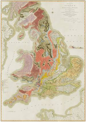
William Smith's 'A Delineation of the Strata of England & Wales with part of Scotland...' (1815)
|
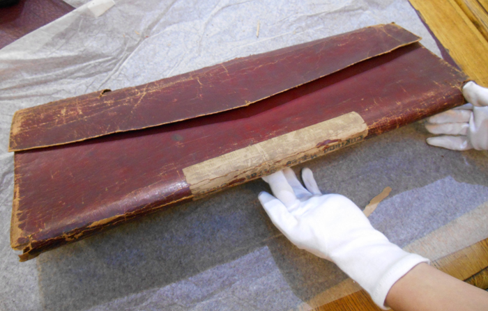
| The battered red Morocco binding enclosing the mysterious item, found in February 2014. You can just make out that the spine label (which is upside down) reads 'England Wales Strata Smith'. |
In February 2014, during an archive audit and repackaging exercise, staff came across a curiously wrapped object. There was no catalogue record identifying what it was but underneath a layer of conservation tissue was a rather battered looking, leather bound item with an equally battered looking spine label.
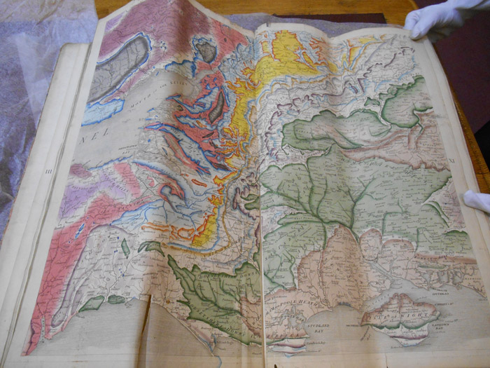
This package would turn out to be the Society’s subscription copy of William Smith’s ‘A Delineation of the Strata of England and Wales, with part of Scotland…’ (1815), identified from the colouring which indicated that it was one of the earliest copies issued around September 1815. This imprint of the first geological map of a nation ever produced, had appeared in various Library catalogues throughout its lifetime but was missing from the modern catalogue which was instituted in the 1980s.
For how many years it had been ‘lost’ was unclear but being hidden from view for decades meant that the colours were extremely bright. However being folded in such a manner meant that the paper would not lay flat and had also weakened and split at certain points of stress.
|
Plate XI showing its still vivid colouring. The map’s fifteen plates were bound together down a centre fold, but the soft morocco case folded it further lengthwise. You can see the paper has split down one of these further folds on the left.
|
|
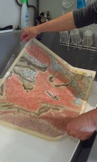
The conservation process saw the sheets being cut from the Morocco binding then dry-cleaned. They were then immersed in water to both relax the paper fibres and remove acidity. The sheets were then flattened and repaired with Japanese tissue. |
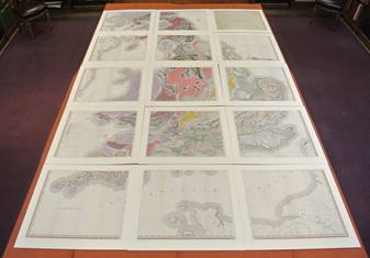
Usually, when considering conservation, best practice is to return the object to its original format. However the original format was clearly problematic so it was decided that the sheets should remain separate and not rebound again as it would give more flexibility for usage and display.
|
|
|
The conserved map laid out for the launch event for the William Smith bicentenary on 23 March 2015.
|
|
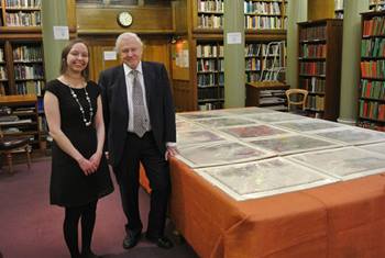
Vicky Woodcock (who found the map) with Sir David Attenborough, 23 March 2015.
|
|
The Geological Society’s Library would like to thank
Dr Peter Dolan
Nineteenth Century Geological Maps
Petroc Limited
Dr Dave Williams
whose generosity paid for the conservation and digitisation of this important map.
|