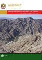
 These 12 volumes and the accompanying maps with descriptions produced by the BGS for the UAE Ministry of Energy provide a comprehensive and up-to-date account of the geology, geophysics, resources and geological hazards of the UAE.
Three volumes are likely to be of interest to the general reader: one on the geology and evolution of the western part of the Hajar mountains (V2), and another on the geology and evolution of the mainly island salt-plugs (V7). The third (V6) contains a description of the subsurface geology and that of the overlying Tertiary rocks, so well exposed in west of the UAE. There is a detailed description of the extensive inland cover of dune-sand and the deposits of the barrier-islands, lagoons and coastal plain. This includes a discussion of their contentious Quaternary evolution (see Stevens et a.,l 2014) using abundant OSL and U-Pb zircon dates.
The availability and future potential of various economic deposits, excluding oil, is discussed in vols. 3, 9, 10 and 11. The limestone resources, particularly dimension stone (widely used but mainly imported - V11), building aggregate, armour stone for harbour and coastal defences, rock wool and rock for tile manufacture as well as other construction materials are also considered (V10). Surprisingly, there is a lack of high quality silica-sand in this desert area due to impurities and unsuitable grain size of the dune-sand.
The occurrence of various economic mineral deposits (copper, chromite, platinum minerals etc.) in the ophiolitic rocks of the Hajar mountains are described (Vs 3,8) although these are not thought to be economic at present.
There is a review of the hydrogeology (V3) although this is relatively unimportant, except in local areas of agriculture, as the major part of the water consumed is produced by desalination of seawater.
The geohazards of the region are discussed in V4 including the plate-tectonic setting of the surrounding area and its history of its seismic tremors and tsunamis. It is concluded that the UAE is a low risk area. The other geohazards of the:mountain front (rock falls, rock slides); alluvial fans (mainly flash-floods); the desert (dust and blown sand) as well as those of the coastal plain (aggressive ground water, liquefaction and variable strengths of sediments) are also considered.
Surprisingly there is no discussion of likely future problems posed by sea-level rise in a country whose major developments occur on a low coastal plain only a few metres above high water mark.
Various volumes (Vs 1, 5 & 12) of appendices and of executive summaries and others give further details of the geology and geophysics of particular areas and the sedimentology and palaeontology of some of the rocks of the Hajar mountains.
The volumes are all beautifully illustrated with abundant figures and photographs and a useful bibliography. The series will undoubtedly be extremely useful to geologists, engineers and planners.
Reference: Stevens, T., Jestico, M.J., Evans, G., Kirkham, A., 2014. Eustatic control of late Quaternary sea-level change in the Arabian/Persian Gulf. Quaternary Research 82, 175-184
Reviewed by Graham Evans
THE GEOLOGY AND GEOPHYSICS OF THE UNITED ARAB EMIRATES: (12 Volumes by various authors and of various dates 2006 - 2012). Ministry of Energy, United Arab Emirates. W: http://www.bgs.ac.uk/research/international/UAE.html