Product has been added to the basket

Three New Reviews

Geology of Peninsular Malaysia


C S Hutchison and D N K Tan (eds)
Published by: The University of Malaya and the Geological Society of Malaysia
Publication date: 2009
ISBN: 978-983-44296-6-9
List price: 200 Malaysian Ringgit +p&p (approx. £35.00)
479 pp + folded map


E: [email protected]
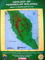
HutchinsonIt is now nearly 40 years since the Geology of the Malay Peninsula (Gobbett and Hutchison, 1973) was published. In the meantime, the country’s tin-mining industry has collapsed and an offshore oil and gas industry has been developed. At the same time an enormous amount of new geological information has been accumulated through the efforts of Malaysian and overseas geologists, and the whole conceptual basis of the geology of West Malaysia has been revolutionised through the application of plate tectonics.

This new volume will be welcomed by all geoscientists with an interest in the country and its region. It commences with a brief biography of each of the contributors, followed by an account of the geomorphology - mountainous interior dominated by linear granitic plutons with local areas of spectacular limestone tower karst, margined by narrow coastal plains and tidal flats, with mangrove swamps along the west coast. An overview of the regional tectonics is then followed by a short chapter detailing the geology of the Bentong-Raub Suture, a major structural feature bisecting the peninsula. This is interpreted as the zone of collision between two major plates, Sibumasu (Sino–Burma-Malaysia-Sumatra) and Indochina, which separated from Gondwana in the Palaeozoic and came together to form Southeast Asia in the Triassic.

Separate chapters are devoted to Palaeozoic, Mesozoic and Cenozoic stratigraphic units, detailing all the formations recognised in Peninsular Malaysia, with their definitions, lithology, palaeontology and evidence for their age. Noteworthy units include the intriguing Permo-Carboniferous Singha Formation, with its glacio-marine ‘pebbly mudstone’ deposits and diamonds, relating West Malaya to its origin in northwestern Australia as part of Gondwana. The eastern part of the peninsula includes Carboniferous, Permian and Triassic rocks with volcanics and plant beds containing Gigantopteris, linking the eastern part of the peninsula to Indochina and China.

In the Triassic the peninsula was the site of massive plutonic intrusions, but was largely exposed subaerially with marine and terrestrial sedimentation in a central graben structure. The Jurassic and Cretaceous are characterised by terrestrial red beds. Terrestrial Cenozoic deposits are restricted to small local basins on the eastern and western margins of the peninsula, some containing coal seams. Cenozoic deposits are more extensive in faulted graben offshore, to the west in the Malacca Strait and particularly to the east in the large hydrocarbon-bearing Malay and Penyu basins in the South China Sea. These basins are described in detail by Denis Tan, lately of Shell, with maps (and accompanying cross sections) showing the locations of oil and gas fields, and discussion of their origin and structural and sedimentary development. Their history of exploration and development are described in a separate chapter.

Further chapters cover other aspects of the geology: volcanism, plutonism, metamorphism, fault structures and deformation, tectonic evolution and mineral deposits. The volume is profusely illustrated with maps, diagrams, vertical sections and half-tone field photo’s and fossils. There are a few spelling errors in the text that should have been eliminated by more careful editing. The reference list shows that the greater part of geological research on the peninsula has been published in the Memoirs of the Geological Survey of Malaysia (now the Minerals and Geoscience Department Malaysia), local journals and volumes derived from regional seminars, so that it has not received wide circulation. This volume has a key role to play in improving access to this information. Together with accounts recently published or in preparation on the geology of North Borneo, Indonesia Borneo, Sumatra, Thailand and Vietnam, it will go a long way towards defining our present knowledge and understanding of the geology and geological history of mainland Southeast Asia, and will provide a sound basis for future research.

Reference:

  • Gobbett, D.J. & Hutchison, C.S. (eds) 1973. Geology of the Malay Peninsula. Wiley-Interscience, New York, 438pp

Tony Barber
Department of Geological Sciences, Royal Holloway University of London


Soil and Rock Description in Engineering Practice


David Norbury
Published by: Whittles Publishing
Publication date: April, 2010
ISBN: 978-1904445-65-4 (hbk)
List price: £80.00
301 pp


www.whittlespublishing.com

NorburyThere is not much point in being an engineering geologist if you cannot describe soils and rocks in such a way that your readers can visualise them for themselves, as if they had actually been there. A key skill of the engineering geologist is the development of the conceptual ground model, because this feeds into the rest of the engineering design process. As Norbury writes, the logger may be the only person ever to see the samples.

He has drawn on 20 years experience of presenting training courses on the subject, derived from a life’s work getting his hands dirty and helping to draft the standards we use. This is a very thorough book and is well presented and printed, with clear tables, helpful thumbnail photographs and figures and text boxes containing tips and example descriptions. It is aimed at the doers and the reviewers.

It does not just tell the reader what is required, but how to do it. For example, there is a series of photographs of samples ranging from slightly sandy GRAVEL to slightly gravelly SAND, showing the total sample and its component sand and gravel fractions. A little diagram helps users convert the volume proportions they see to the mass proportions needed to define the boundaries that make up terms such as ‘slightly’. Did you know, for example, that 40% gravel by mass is only 28% by volume?

There are photographs of dirty hands to help differentiate between silt and clay, plus some interesting historic background on topics such as the much-debated silty CLAY, SILT CLAY, SILT/CLAY issue. The book covers all the new requirements linked to Eurocode 7. It even lists some descriptions through the ages to show how things have changed - useful if referring to old reports.

Less common materials are also covered, such as concrete and blacktop. Do you know the difference between tarmac and asphalt? Do you know what orange mottled grey looks like? Have you actually seen gleying; or is it just something you put on your logs because it sounds good? Do you know how to mark out fractures on the core box to aid the measurement of fracture spacing? Would you be able to estimate the strength of a rock by hitting it with a hammer and listening for a whop, thwack, ploink, plink or dink?

Buy this book.

Kevin Privett
Hydrock, Bristol

Exhibition: From Dust to Diamonds


Dates: 7 July - 12 November
Time: 08.00-20.00
Location: North Cloisters, Wilkins Building, Gower Street, London WC1E 6BT
Price: Free
Age group: Any


Diamond ExhibitionFrom Marilyn Monroe to those girls selling Diamond insurance, we all know which gemstones are a girl’s best friend. However, although their criteria may be different, they are an invaluable tool to the geologist too, as this exhibition sets out to demonstrate. This exciting, in-depth look into diamond as a mineral, not only shows how its extreme physical properties can be valuable to science and technology, but goes on to explain its more familiar role as the sought-after gemstone.

Celebrating 60 years of diamond research in UCL’s Earth Science department, the exhibition cases brim with dazzling gems, some as large as tangerines - and tidbits of information such as why a metric carot is 0.2g (traders of yore would use carob seeds to counter balance their diamond weights). With so many beautiful specimens from the UCL stores also showcased, it soon becomes hard to tell the real from the synthetic.

Diamonds form on the Earth in only two habitats; high pressure-high temperature areas of the lower mantle, whence they come to the surface through volcanic eruptions, or in meteorite impacts. Most recently, science has focused on carbonados, black diamonds of controversial origin (soon to be the subject of a Geoscientist feature); and more discerning filmgoers among Geoscientist’s readers may have recognised Carrie Bradshaw’s engagement ring (in the latest Sex and the City film) to be one of these gems.

The rarity of diamonds makes them extremely valuable, and also incredibly interesting for research. However, an expert from the Gemological Institute of America, present at the exhibition’s launch-night, told Geoscientist that often, a simulant diamond can be more useful for science as “geologists like to see if diamonds can form under different pressure-temperature settings and in different host rocks to test the survivability of diamonds as a tool for the deep-Earth carbon cycle”.

When it has been said that the modern woman chooses diamond jewellery based on sheer beauty, Sami Mikhail (currently researching his PhD on diamonds at UCL) explained how modern geologists would choose theirs for their flaws, because diamonds with inclusions are “arguably the most insightful as these make them unparalleled tools in directly sampling the deep Earth.” Although I am not sure every geologist would agree that a diamond with a flaw is better than one without, this exhibition is definitely an unblemished jewel from the geology collections of University College London.

Harriet Jarlett