 Geohazards in Indonesia
The volume is made up of 11 papers, including the introduction. With two exceptions, the direct application of the papers by emergency managers is not presented. This makes the full title somewhat misleading and the purpose of the volume inappropriate. In addition, the bulk of the papers’ focus is on faulting and seismicity, estimating fatalities, or earthquake early-warning. This is disappointing since there is a significant amount of geologic hazard and related risk reduction information in the published literature, including volcanic hazards, tsunamis, and landslides.
There is a brief mention in one paper on the introduction and implementation of an Indonesian Tsunami Warning System and how the warning is carried out to public officials and emergency managers, even though locally there have been efforts to educate said audience and the public as to what to do if a tsunami warning is issued or strong ground shaking occurs at or near the shoreline. Since the tsunami warning system was first deployed there have been several tsunamis to strike potions of the country; however, there is no mention of how successful the system has been in alerting government officials including emergency managers as well as the public.
The same paper discusses the development of SHAKE MAPS for Indonesia. The maps do not use Indonesian specific ground motion prediction equations. The use of SHAKE MAPS in Indonesia is briefly discussed without a demonstrated tie to their use in disaster risk reduction or the use by emergency managers in mitigation, preparedness planning, public education, post-earthquake emergency response or in recovery operations.
The paper on the development of a Bayesian approach to fatalities estimating does not account for the topography or building types of the sites used as a control. In addition, a concise output is needed for use by the user. This method appears to need further development before it is useful.
Overall, I found the volume interesting but generally not directly useful in developing and implementing disaster risk reduction schemes for emergency managers, utilities or the insurance industry. If the volume had been renamed it may have had been clearer to the reader as to the usefulness on the papers contained therein.
Reviewed by Robert Anderson
GEOHAZARDS IN INDONESIA, EARTH SCIENCE FOR DISASTER RISK REDUCTION edited by P R CUMMINS AND I MEILANO. Published by the Geological Society of London, ISBN: 978-1-86239-966-2 List Price: £90 Fellows Price: £45 Website
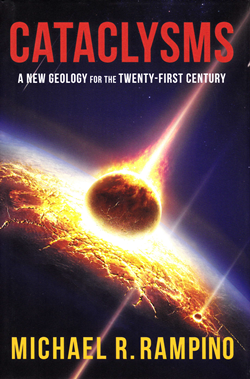
 Cataclysms – a new geology
The debate between Catastrophism and Gradualism has swung to and fro for 250 years. It involved many of the fathers of geology, not least Hutton, Cuvier, Dana and Lyell, and it provided a uniformitarian framework for Darwin’s ideas in the Origin of Species. It had been difficult to obtain evidence for extra-terrestrial activity in the geological record, but this changed dramatically with the evidence for the impact structure of the Chicxulub Crater in 1990 and its link to the extinction of the dinosaurs.
Michael Rampino has long been interested in, and an advocate of, extraterrestrial processes in shaping the history of the Earth. The book is well written and easy to read, and it is personal in that it documents the development of his ideas and some of the research he himself undertook. It is engaging, but also verges on the adversarial in setting up Catastrophism versus Gradualism, when in the end it concludes that both may have been important in creating the geologic record we see today.
Overall this book describes a journey as the author shrugs off what he regards as the shackles of Lyellian Gradualism, accepts the role of an impact in the mass extinction at the end of the Cretaceous, and explores what other aspects of the geological record might reflect extra-terrestrial activity.
Much of the discussion of the role of extra-terrestrial processes involves establishing that there are regular cycles, as in for example the timing of mass extinctions. Cyclical activity is a feature of the geological record and so one challenge is to distinguish those cycles that imply extra-terrestrial activity. The case for periodicity in mass extinctions and its relationship to astronomical drivers is not new and remains controversial.
More broadly there remains some unease in the matching of patterns of different changes with time, although this seems more acceptable in some disciplines than others. Cataclysms contains much discussion of the kinds of physical changes that might result from impacts, climate change, anoxia, acid rain, volcanic winters, but less on the biological consequences of environmental change on different species, which seems to be a key step in the argument. Perhaps it has yet to be established that different impact events are characterized by different effects on the fossil record that might in turn characterize the kinds of impacts.
The last chapter notes there is evidence for ~30 Myr cycles related to changes in sea level, tectonics, palaeomagnetism, and discontinuities in sea-floor spreading rates. This is intriguing given that the periodicity suggested for extinctions is ~26 Myr. Every 30 Myr or so the Earth in its cosmic orbit is thought to pass through clumps of dark matter. Such matter could be a periodic source of energy, and Rampino speculates that this might be a way for the generation of 30 Myr cycles on the Earth to reflect extra-terrestrial activity.
Reviewed by Chris Hawkesworth
CATACLYSMS – A NEW GEOLOGY FOR THE TWENTY-FIRST CENTURY by MICHAEL RAMPINO. Columbia University Press (2017) ISBN 9780231177801 224pp List Price (hbk or e-book): £27.95 Website
 Ocean Worlds
It is hard to imagine that thousands of years ago, the cafe in which I sit was buried under hundreds of metres of ice. With water locked up in ice on land, sea level was lower and global temperatures cooler. This all occurred well before the invention of the written word so how do we know? Subtle compositional changes in rocks, sediments, and ice hold the key along with the talented men and women who decoded them.
Ocean Worlds tells not just the story of how our oceans came to be and how they will evolve, but also the journey of human discovery that allowed us to understand these dynamic bodies of water. The story of Earth’s oceans is fundamentally intertwined with the formation of our solar system, a topic covered in great detail in the book together with the heated debate surrounding the origin of Earth’s water.
As humanity’s reliance on fossil fuels warms and pollutes the planet ever more, the oceans are undergoing unprecedented change. Hunger for more protein from the seas is irrevocably altering the balance of marine ecosystems. But to what end? Is there a way to prevent disaster? Dipping into the policy side of climate change the authors make some interesting points here in a chapter on Oceans in crisis, while giving a brief history lesson on human effects on oceans in the last few hundred years.
The last two chapters are particularly fascinating as the focus shifts away from Earth and to distant shores in both space and time. As we explore our solar system with increasingly advanced probes and landers it has become apparent that oceans exist on some of our neighbours, the moons of Saturn and Jupiter being obvious examples. The debate about water and an ancient ocean on Mars comes with the tantalising possibility of alien life and how to find it. With increasingly sophisticated space telescopes we are now able to look beyond our own solar system to discover oceans on truly alien worlds.
This book crams a lot of information into its 265 pages, all well referenced with notes at the back. From pirates to exoplanets and penis-worms to space probes this is truly the story of water, life, and discovery. A must-read for those with a hunger for general knowledge, or any interest in the topic. Everyone will certainly find something new to explore further in this fascinating and accessibly written book.
Reviewed by Jonathan Scafidi
OCEAN WORLDS: THE STORY OF SEAS ON EARTH AND OTHER PLANETS by JAN ZALASIEWICZ & MARK WILLIAMS, 2017. Published by: Oxford University Press 294pp (pbk) ISBN: 9780199672899 List price: £11.99. Website
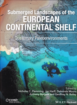
 Submerged Landscapes of the European Continental Shelf
This volume is the product of a European-wide research collaboration named SPLASHCOS, ‘Submerged Prehistoric Archaeology and Landscapes of the Continental Shelf’, financially supported by the Co-operation in Science and Technology office in Brussels. Over 100 researchers from 25 European countries took part, 65 of whom are credited with having contributed to this present volume, which is the first volume to be published by the initiative. A second volume, ‘Archaeological Data and Interpretations’ is to follow.
A central objective of the book is to answer the question of why some seafloor prehistoric evidence survives inundation by sea-level rise, when others are destroyed by wave action and currents. The book provides an analysis of general marine and coastal processes in early chapters, before dedicating the majority of the content to 14 chapters detailing the regional sea basins of Europe, summarising their geomorphology, oceanography, and examples of known archaeological sites.
These chapters do an excellent job of summarising a vast amount of data, originating from multiple disciplines. Although the exact content of each chapter varies, typically they adopt the following format.
First, the Quaternary geology of each region is described in detail, aided by a considerable number of maps and profiles of sea-level change. Next, the effect of climatic conditions on human migration is considered. This is followed by a summary of submerged terrestrial landforms which may be associated with archaeological sites.
For example, within the North Sea chapter, this largely focuses upon the complex environment of the Dogger Bank. Finally, an assessment of the archaeological potential of each basin is given; this is based upon environmental factors and the distribution of known sites.
The volume is impressively well-referenced and up-to-date throughout. Data examples are largely extracted from existing articles, and complement the text well. The only negative of the need to source figures from various sources is a lack of consistent presentation. This lack of uniformity is also apparent in the writing style between chapters to some degree. However, this does not detract from the general flow of the book. Another minor comment would be on the absence of a concluding chapter, which would have aided the overall understanding of why some archaeological sites are preserved, but not others.
This is an impressive volume, offering a useful reference to all those working or interested in the European continental shelves.
Reviewed by David Vaughan
SUBMERGED LANDSCAPES OF THE EUROPEAN CONTINENTAL SHELF: QUATERNARY PALAEOENVIRONMENTS by FLEMMING, N C, HARFF, J, MOURA, D, BURGESS, A, BAILEY, G N, (eds) 2017. Published by: John Wiley & Sons 533pp (hbk) ISBN: 9781118922132 List price: £80.00 Website
 Silver - Nature and Culture
It has become popular over the last few years for authors to highlight a mineral commodity, and marry science and cultural history behind it. Silver has been a useful element since early history; coins, medicine, photographs, teeth, swimming pools, ceramics, socks, bandages, homeopathic medicine, utensils, dining ware, sporting trophies, jewellery, cars, planes, space vehicles, electronics, computers and phones are just some of the use of this malleable metal. It was silver that drove the development of South America and the establishment of trade routes from Spain to China, including the settlement of the Philippines and Macau by the Spanish. Although gold initially drove the development mining camps throughout the south-west USA, it was silver that built the cities and towns of Nevada, the Rockies and Mexico.
This book seeks to explain the history behind the metal, and in this respect it succeeds. However, it also has its limitations. For me the largest area of contention is the limited geological content. When I think of great silver mining camps I think of Comstock, Rochester, Tonopah, Butte and Creede in the USA; Fresnillo and Zacatecas in Mexico; Potosi in Bolivia; Cobalt, Ontario; Kongsberg in Norway; Erzebirge in central Europe and Lauiron in Greece. Needless to say when Alva, a small but largely irrelevant occurrence in Scotland is afforded more space than many of these ‘world-class’ deposits, then there is a problem. Creede is not even mentioned, and Cobalt only in passing.
Despite my disappointment over this aspect, the history and cultural importance of silver is covered in admirable detail. The book is well illustrated with excellent maps, historical images and photographs. The bibliography is limited and focused on the main aspects of the book.
This is an enjoyable light read and is recommended to anyone with a passing interest in this most versatile of metals.
Reviewed by Rob Bowell
SILVER: NATURE AND CULTURE by LINDSAY SHEN 2017 Reaktion Books. ISBN 9781780237565 List price: £14.95 Website
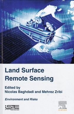
 Land Surface Remote Sensing
This book is the sixth volume in a set which aims to provide postgraduate-level information on the physics and applications of remote sensing. Out of nine chapters, only four (119 pages of 337) cover areas of specific geological interest. The other chapters cover deforestation, wildfires, industrial plumes, locust management and epidemiology. This will therefore be a volume primarily for library or online/digital consultation by geologists.
Digital consultation would also be important since the printed book reviewed here is in a relatively small format and the important illustrations are mostly far too small and sadly exclusively in B&W; many of the grey-tone images reveal nothing at all. URLs quoted in the figure captions provide only error messages. An e-book version is available, which presumably does have the colour illustrations.
The Drylands and Desertification chapter is relatively short (19pp) and focuses on vegetation and environmental issues rather than geomorphology. The chapter on Earth surface motion and geomorphic processes is limited to optical image correlation techniques and has been abstracted from reports on the EC-FP7 Safelands; Living with landslide risk in Europe. It gives a good summary of the physics behind optical image correlation but the application examples are quite limited and sadly no comparison is made with interferometric radar techniques which probably show more promise in this area.
The chapter on monitoring the environmental impacts from mining is also restricted to optical remote sensing, but undoubtedly is of value since it contains good case-studies within a relatively under-documented topic. The chapter on the contribution of SAR data to volcanology and subsidence studies does contain a good and concise summary of the theory behind interferometric radar, and although the actual application examples are rather limited, there is an extensive and comprehensive bibliography.
The editors stress the value of a holistic cross-disciplinary approach to the subject but this reviewer feels geologists will find the cover-price too high relative to the specific content and be interested only in the directly relevant chapters. With the plethora of new Earth-observation satellites currently being launched, there may be more postgraduate students from other disciplines seeking better broad knowledge of remote sensing for whom this book would provide an appropriate introduction.
Reviewed by Nigel Press
LAND SURFACE REMOTE SENSING: ENVIRONMENT AND RISKS by NICOLAS BAGHDADI & MEHREZ ZRIBI (eds), 2016. Published by: ISTE Press 337pp (hdbk) ISBN 978-1-78548-105-5 List Price: £104.00. Website