William Smith maps for sale
 William Smith’s county maps have been photographed in high resolution
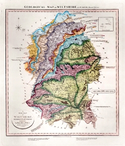
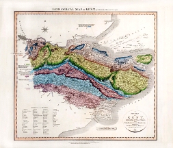
Paul Johnson, map Librarian, writes: The Library has had its complete atlas of William Smith’s County Maps photographed - which means that we can now supply high-quality prints of any of the 21 counties whose geological maps Smith published between 1819 and 1824. These were a follow-up to his famous 1815 map of Britain, and were produced in conjunction with John Cary whose ‘New and Correct English Atlas’ of topographic county maps had been selling well since the 1780s.
All the maps can now be viewed on www.geolsoc.org.uk under ‘Library and Information Services’. Here you will also find a brief history of the maps and details of both the cost and how to order prints. Paul Johnson