Earth History & Palaeogeography
Once in a while a book comes along which you know will become a classic. But then it really should - as it comes about as a result of collaboration between two authors at the top of their respective disciplines. But that on its own is no guarantee of quality!
However here, Torsvik and Cocks have combined forces in apparent close harmony with their publisher and printer to present a thorough yet accessible evolution of the Earth. The quality of the full colour graphics, cartography and text is rare in a modern book of reasonable cost; indeed, this sets a benchmark .
The authors introduce the volume by explaining the various techniques used to evaluate the position of the tectonic plates through time, with a discussion about the merits and uncertainties associated with the methods.
The core of the work consists of detailed maps for each era, period and epoch, accompanied by the evidence for the movement and history of each of the 926 tectonic units of the Earth, and some of the biological and environmental indicators prevalent at the time. The last chapter briefly explores how paleoclimates have evolved, and the techniques used to decipher the signals in the rock.
This treatment successfully treads a difficult line between just writing the plain, unvarnished facts and painting an interesting geographical interpretation. The number of references has been carefully selected so that the work is not overwhelmed with too many citations; the reader is allowed to enjoy the text. Nevertheless we are given sufficient information to pursue the details further online, where access is also given to the Earth models.
I particularly liked the device of using a ‘time bar’ throughout the text, to allow the reader to follow the various time steps and sequence of comparable events. This knits the whole story together in a very memorable way.
The evidence available for the whole globe remains patchy. However I can envisage that this work will stimulate effort on filling in those gaps in the details, and hence could be taken further and republished as an
Atlas of Paleogeography, perhaps incorporating palaeobiology in its next edition.
But that is no doubt some way off. Meanwhile, we have a really interesting book, very well presented, which will stand the test of time and enjoy a broad appeal among geologists at all levels of ability. I shall be taking my copy to the proverbial desert island.
Reviewed by Arthur Tingley
EARTH HISTORY & PALAEOGEOGRAPHY by TROND H TORSVIG AND L ROBIN COX 2016 Cambridge University Press. ISBN-13: 978-1107105324 Hardback. List Price: £44.99. W: www.cambridge.org/core/books/earth-history-and-palaeogeography/

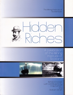
Hidden Riches
This is an unusual book, and ‘Hidden Riches’ are indeed buried among its pages. As a celebration of the Mining Institute of Scotland (MIS), it “...is not a social history of mining or of mine workers...rather it is presented as a tribute to the inventiveness and professional skills of a small body of engineers and specialists on whose shoulders ultimately the success of a significant part of Scottish industrial history rested in the past and continues to do so in the changed circumstances of the present day”.
The book’s preface addresses the importance of preserving records for future generations - especially anecdotal material, which will be lost with the inevitable demise of the current older generation of mining professionals. Preserving this material is deeply important to ensure that lessons from the past, costly in both finance and human life, do not have to be repeated.
The MIS itself was established on the back of a costly accident, with the aim of bringing together various relevant industry professionals to further the prevention of accidents and the advancement of mining science. This, along with professional registration, has been the role of the MIS throughout its existence. Hence this is an important book; it feels somewhat like a bequest, in recognition of people who have shaped history. Equally important and interesting are the lessons learned by the Institute itself, and how it has adapted to the changing needs of the industry and its members.
This usefully illustrated book is arranged in two distinct halves: the first being a collection of histories including the development of the Scottish mining industry and the establishment of the MIS. The historical contributions of MIS members to the coal, oil and gas, gold and other minerals, and mining machinery manufacturing industries have been significant. The final half of the book features biographies of 13 MIS members, illustrating the widely varied professional roles of the membership through huge changes in the mining industry over a relatively short period. Some interesting career pathways are described, and sound career advice is noted. The importance of the MIS in many of these careers is evident, in the provision of new information, as a forum for discussion and for CPD.
Vitally (and despite my reservations about its editing and binding!) members of the MIS, indeed anyone involved with mining, should purchase this book, which is not a big ask at just a tenner.
Reviewed by Catherine Kenny
HIDDEN RICHES: A CELEBRATION OF THE MINING INSTITUTE OF SCOTLAND by RICHARD CROCKETT with contributions by Craig Durham and Graham Smith, 2014. Published by: The Mining Institute of Scotland plc 134pp ISBN: 978-0-9929058-0-4 List Price: £9.99. W: www.mining-scotland.org

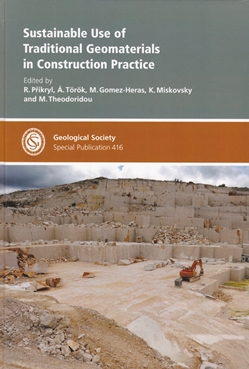
Sustainable Use of Traditional Geomaterials in Construction Practice
This Special Publication of the Geological Society of London presents 22 original research papers in the field of geomaterials used in construction. The research papers are grouped in four sections and discuss sustainability issues, sources and performance of local natural stone, properties and durability of natural stone and aggregates, and weathering and conservation of geomaterials.
The extraction and use of inorganic raw materials derived from the Earth’s crust, termed ‘geomaterials’ in this special publication, have been the main features that distinguish modern man from his man-ape ancestors. The concept of sustainable use of raw materials is discussed, encompassing the reduced extraction of primary resources and the employment of technologies and maintenance strategies to produce less harmful substances and minimise impact on the environment.
The research papers refer to traditional geomaterials and their use in construction in Italy, Germany, Austria, Portugal, Spain, France, Turkey, Cyprus, Netherlands, Egypt, Hungary and Greece. The geomaterials presented include a variety of lithologies such as marble, limestone, chalk, sandstone, breccia, conglomerate, granite, tuff, and gneiss.
Most of the research papers are written by geologists. However, the plethora of information presented on availability, accessibility, workability, durability, serviceability and sustainability of the geomaterials will also be of interest to those working in civil engineering, especially architecture and landscape engineering, as well as cultural heritage and monument conservation professionals.
In the context of the sustainable use, innovative methodologies are presented in detail along with the more widespread concepts of recycling and down-cycling. To name a few of the innovative methodologies discussed: employment of micro-destructive techniques in the characterisation of monumental stone, potential applications of residual sludge from dimension-stone working plants, use of nano-composites for stone protection and monument and historical buildings protection, GIS database techniques to establish stone replacement strategies. Examples of the successful use of these methodologies are presented.
The detailed study of geomaterials’ physical and mechanical characteristics, together with an understanding of their geological origin, environmental context and mode of use, are emphasised as key factors for the application of effective conservation and rehabilitation actions and their overall sustainable use.
This is a comprehensive contribution in the field of geomaterials in construction, enriched with high quality graphs, location maps, data-tables and schematic diagrams. It is a recommended read and reference work both for specialists and non-specialists.
Reviewed by Christos Botsialas
SUSTAINABLE USE OF TRADITIONAL GEOMATERIALS IN CONSTRUCTION PRACTICE by R PRIKRYL, A TOROK, M GOMEZ-HERAS, K MISKOVSKY & M THEODORIDOU (Editors), 2016. Published by the Geological Society of London, Special Publication 416, 311pp (hbk) ISBN:9781862397255 List Price: £120; Fellows: £60. W: www.geolsoc.org.uk/SP416

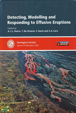
Detecting, Modelling and Responding to Effusive Eruptions
The direct and indirect effects of volcanic eruptions have the potential to cause extreme humanitarian disasters, particularly within vulnerable populations located in resource-poor regions of the world. Volcanic eruptions cannot be halted by human action. Effusive styles of eruption (characteristically with lava fronts progressing at relatively slow rates) however have the potential to allow sufficient time to appropriately respond to an advancing lava front when an effusive eruption event is underway.
Developed from initial discussions within the European Commission Joint Research Centre, the RED SEED (Risk Evaluation, Detection and Simulation during Effusive Eruption Disasters) working group was established to initiate collaborative exchange between volcano science, operational support providers and actual event responders. A key objective is to develop new requirements and services (or ‘products’) that can directly inform and benefit future humanitarian responses during these events. This GSL Special Publication is the first production from this working group, presenting an overall statement of intent and need, a directory of currently accessible capabilities and operational service providers, and an ‘events’ simulation intended to demonstrate how a multi-disciplinary response to these crises is viable.
Introduced with an overview summary paper, the volume is arranged in four interrelated main thematic parts and a comprehensive concluding section - 1: Volcano hotspot detection, tracking and targeting, 2: Towards operational tracking and dissemination systems, 3: Lava flow modelling and 4: Application in crisis-mode: experiences and requirements. The final section presents the extensive initial findings and recommendations of the RED SEED group and a detailed test simulation for a proposed geographical information system (GIS) to enable damage and evacuation assessment during an effusive eruption event.
This publication is undoubtedly an important data reference source that documents current insights and progress within the science and technology underpinning the humanitarian responses available (or required) to effectively mitigate the impacts of effusive eruption events. The anticipated readership will be geoscientific, technical and engineering practitioners working within this field (and contributory disciplines), as well as humanitarian responders requiring a thorough contemporary understanding of the scientific developments informing their decision-making.
Reviewed by Mark Griffin
DETECTING, MODELLING AND RESPONDING TO EFFUSIVE ERUPTIONS by HARRIS A J L, DE GROEVE T, GAREL, F AND CARN, S A (eds). Geological Society of London Special Publication No 426. 2016. ISBN 978-1-86239-736-1. Hbk. 683pp. ISSN 0305-8719. List Price: £140.00, Fellows' Price £70.00 www.geolsoc.org.uk/SP426.

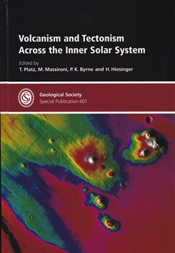
Volcanism and Tectonism across the Inner Solar System
This is an important yet challenging publication that, for non-experts like me, requires a lot of lateral investigation. There are unexpected rewards.
The book contains a valuable 57-page overview followed by 27 geological articles - all fully referenced. The overview is a welcome explanatory primer for the articles that follow. Four editors assisted by 35 reviewers put all this together. Given the multitude of authors (111), and their diverse mother-tongues, the text is surprisingly clean. The false colour imagery is truly ‘out of this world’.
The articles originated from European Geosciences Union General Assembly sessions held between 2010 and 2014. Published in 2015, the sessions were a timely opportunity for these specialists to update their thoughts on enigmatic Mercury. Early imagery is now available from the Messenger probe that orbited the planet between 2011 and 2015. Surface coverage is virtually complete and the improved imagery (Mariner 2 flew past in 1974-75) has brought more certainty to some hotly debated issues.
Smooth plains that are probably either pyroclastic or igneous in origin are now shown to cover 27% of the planet surface. The largest area, the Northern Volcanic Plain is, thought to have formed about 3.75Ga ago in a single voluminous event with extensive melting of Mercury’s mantle. XRS evidence suggests a magnesium-rich basaltic composition. Important geological features of Mars, Venus, Earth, the Moon, and the inner asteroids are discussed in other papers.
I needed an up-to-date geological dictionary to check unfamiliar terminology and found some interesting information in (dare I say it?) Wikipedia. Names add charm, and Mercury is not only home to blind thrusts and wrinkle ridges but a domicile for earthly greats like Rembrandt, Beethoven and Tolstoy (all craters). It is an astonishing though irrelevant fact that there are now 26 International Astronomical Union-approved goddess names for Venusian coronas that start with the letter A. They include the Quechua potato goddess, Asamama. Quirky.
By far the most salient point is that this book is available in digital form with the option of high or low image resolution. The former is preferable - not that I can shed greater light on the underlying issues - but because I can look deep into an alien landscape. The detail will guarantee further delving on sleepless nights.
Reviewed by David Edwards
VOLCANISM AND TECTONISM ACROSS THE INNER SOLAR SYSTEM by PLATZ et al., 2015. Geological Society Special Publication #401 ISBN 978-1-86239-632-6 448pp. List price: £ 130.00 Fellows’ price: £ 65.00 Other societies’ price: £ 78.00 W: www.geolsoc.org.uk/SP401

Sensing and Monitoring Technologies for Mines and Hazardous Areas
This text offers an overview of a selection of hazardous issues requiring management in underground coal mining. In addition, open-cut stability hazards and associated slope monitoring methods are the focus of the first chapter. A similar chapter focusing on geotechnical aspects of underground strata control is absent.
This seemingly inequitable balance between underground and open-cut mining is questionable, given the book is, according to the publisher, targeted at geotechnical and mining engineers. In reality, different aspects of the book will be useful to a wide range of students and practitioners. For example, the first chapter provides an exposition of slope stability problems, of interest to undergraduate engineering geology students, but not to electrical engineers working underground.
Fundamentally, the book leans heavily on Indian coal-mining systems, procedures and examples, and this could have been extended to provide a more international context. This has been attempted in part, for example in Table 4.2, which provides a global list of coal mining accidents from explosions, but the selection criteria for inclusions is uncertain.
Some notable omissions that would have increased the international context include the three Moura Mine explosions in Queensland, Australia, and New Zealand’s Pike River Mine disaster (29 fatalities in November 2010). Much of the fourth and fifth chapters focus on very specific details of electronic circuitry within underground hazard detection systems.
While this may be of use to electrical engineers working underground in Indian coal mines, it is of questionable interest for mine engineers working elsewhere, where intrinsic safety and technical requirements may be quite different.
The most intriguing chapters are centred on the concept of the Internet-of-Things (IoT) and cloud computing for real-time digital mine management, and this section of the book would be of interest to Technical Service Managers, and graduate students of mining engineering. IoT offers advanced connectivity of devices, systems and sensors beyond machine-to-machine (M2M) communications.
The interconnection of such embedded devices should advance automation in nearly all fields of mine management and safety technology. The emerging vision of an IoT in an underground mining environment raises important technical questions regarding wireless system networks, design and development.
Given that intrinsic safety requirements in underground mining can vary internationally, IoT advances may be difficult to implement in some underground mines, compared with IoT in above-ground industries. In summary, while the structure and content of the book may appear somewhat muddled, it will be a useful addition to students of mine engineering and some industry practitioners.
Reviewed by Martin Brook
SENSING AND MONITORING TECHNOLOGIES FOR MINES AND HAZARDOUS AREAS by SWADESH CHAULYA and G M PRASAD, 2016. Published by: Elsevier 432pp (pbk) ISBN: 9780128031940 List Price: £95.00. W: http://store.elsevier.com/product.jsp?isbn=9780128031940&_requestid=2698098