 The Desert - Lands of lost borders
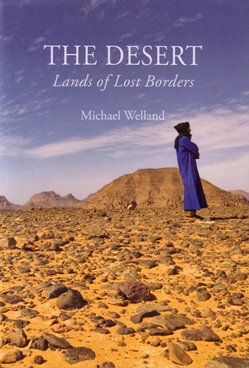
This handsome book is informative, well-illustrated, broad-ranging, and clever. The author, a geologist and professional writer who in 2009 wrote the well-received ‘Sand: A Journey through Science and the Imagination’, has managed to weave together a whole array of different strands that serve to make deserts what they are.
Using some of his own field experiences, coupled with a wide reading of the literature, he has succeeded in covering the science of deserts (including climate, geomorphology, and wildlife), while at the same time discussing the human inhabitants, art and literature, and some of the arresting characters who risked their lives in discovering and traversing the world’s drylands.
It aims, as the author explains, to ‘provide an evocation, a celebration, a consideration of our response to the desert, the idea of the desert’, for ‘deserts are landscapes of the mind as much as physical realities, places of metaphor and myth.’ Using examples from central Australia, the Namib, the Gobi, the Sahara, the Mojave and the Atacama, he examines such landscapes in the context of their place in history, as birthplaces of civilisations, evolutionary adaptations, art, ideology and philosophy. To be sure, it does not cover everything relating to this vast topic, but it provides a superb introduction to what makes deserts so fascinating and alluring.
To give an example of how different material is cleverly combined, consider his treatment of flash floods. The climatic and geomorphological conditions that produce them are described, and there are some graphic descriptions from the literature; but there is also a description of an explorer who was killed by a flash flood in the Algerian Sahara, Isabelle Eberhardt. We learn that she probably had syphilis, was illegitimate, was a habitual user of drugs, was highly promiscuous, and cut her hair like a man.
Equally, some pervasive surface features - stone pavements - are explained scientifically, but are also placed in the context of the disturbance of desert surfaces in the Libyan Deserts by the narrow tyres of Model T Fords used by great desert explorers like Ralph Alger Bagnold. Similarly, dust storms are introduced by a consideration of the life and writings of Mildred Cable and her colleagues in the Gobi, but this is followed seamlessly by a discussion of how the global importance of dust storms has been revealed by the latest satellite-borne sensors.
Lovers of deserts will love this book and will also learn much from it.
Reviewed by Andrew Goudie
THE DESERT. LANDS OF LOST BORDERS by MICHAEL WELLAND, 2015. Published by Reaktion Books, 400pp (hbk) ISBN 978 1 78023 360 4 List Price: £25.00. W: www.reaktionbooks.co.uk.
 Stratigraphic landscape analysis, thermochronology and the episodic development of elevated, passive continental margins
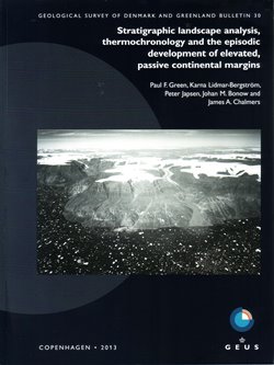
Extensive low-relief plateau surfaces at high elevation, termed ‘peneplains’ in this bulletin, have been a challenge to geologists seeking to explain the long-term evolution of rift-margin landscapes. Attempts to understand these plateaux have long focused on topography, leading to controversial theories of landscape evolution many of which have now been dismissed within current ideas of plate tectonic development of passive margins during continental fragmentation.
This extremely well illustrated book book provides a ‘state-of-the-art’ review of these landscapes with specific focus on new research, particularly with respect to the on-shore/off-shore sedimentary records which has led to a re-evaluation of such landscapes within a new scientific approach termed ‘stratigraphic landscape analysis (SLA)’ (Chapter three).
It provides a concise, thoughtful review of the topic, beginning wth the detailed research on Scandinavian and Greenland landscapes (previously carried out by the authors) before expanding discussion to include other continental passive margins in the southern hemisphere. The early part of the book presents a comprehensive introduction of key points regarding passive margins with useful definition and discussion of terminology, long a source of geological debate, and the formation of different types of surface allowing reconstructions of a relative chronology of landscape evolution. Chapter four introduces low-temperature thermochronology, particularly apatite fission-track methods, to provide a thermal history, thereby allowing better appreciation of the timing of uplift events and the calculation of the amount of bedrock erosion by denudation.
This is exemplified in Chapter five by a detailed investigation of West Greenland, demonstrating the utility of combining stratigraphic landscape analysis with thermochronology to establish multiple uplift and subsidence events following rifting of the continental margin. This is expanded in the subsequent chapter by assessment of the geological evidence from other passive margins, again emphasising that present-day topography may reflect a series of a sequence of episodic post-rifting tectonic and denudational events.
This allows the final chapters (seven and eight) of the book to evaluate critically a number of presently accepted hypotheses for the formation of such passive margin landscapes leading to revised interpretations that reflect the complicated sequence of post break-up uplift and subsidence events revealed by detailed stratigraphic landscape analysis.
Reviewed by Wishart Mitchell
STRATIGRAPHIC LANDSCAPE ANALYSIS, THERMOCHRONOLOGY AND THE EPISODIC DEVELOPMENT OF ELEVATED, PASSIVE CONTINENTAL MARGINS by PAUL F GREEN, KARNA LIDMAR-BERGSTROM, PETER JAPSEN, JOHAN M BONOW & JAMES A CHALMERS Published by: Geological Survey of Denmark and Greenland. Publication date: 2013 ISBN: 978-87-7871-372-8 List Price: DKK 250 + VAT 150pp W: www.geus.dk/publications/bull/nr30/index-uk.htm
 Geophysics for the Mineral Exploration Geoscientist
There is now no shortage of books covering the theory and application of exploration geophysics, and new additions need ‘Unique Selling Points’. For this book, the USP has to be the number and quality of its illustrations. Financial support from industry has allowed colour to be used everywhere, and the importance of captions that do actually explain the figures has been well recognised.
Following an introduction and a general treatment of data acquisition, processing and interpretation common to all methods, there are individual chapters on gravity and magnetics, radiometrics, electrical and electromagnetic methods and seismics (dominantly seismic reflection). There are some slightly odd omissions, and I searched in vain for magnetotellurics, ground radar and seismic refraction. It took me a little time to discover that these are treated (and well) in online appendices.
Presumably their selection of ‘web-only’ content is based on the authors’ assessment of relative utility, and workers on some types of mineral deposit might disagree. The division has, however, one interesting consequence. Since these methods are discussed in the open-access part of the website, you can learn about them (but not the ones chosen for print) free, without purchasing the book!
This is a competent, well written and, within its chosen, deliberately limited field, comprehensive volume. And yet - I would be reluctant to buy it, or recommend it. My reason is simple. Once again, Cambridge has elected to allow only university course directors who are using it as a course text to access significant parts of the online resources. It is not even clear what this restricted material is, because those outside the magic circle have no way of finding out. But on the website it is stated that CUP ‘need to enforce this strictly so that solutions are not made available to students’.
Now this is not a book for schoolchildren. It is aimed at postgraduates and advanced undergraduates, and at people already working in industry. They are being short-changed. Moreover, the decision displays a dispiriting failure to understand what a university is actually for, to an extent almost unbelievable in a publisher that still claims to be a University Press. To deliberately place off-limits some of the routes to self-study is incompatible with the very idea of university education. It would be barely acceptable if applied to a text for sixth forms.
Reviewed by John Milsom
GEOPHYSICS FOR THE MINERAL EXPLORATION GEOSCIENTIST by MICHAEL DENTITH & STEPHEN T MUDGE Published by Cambridge University Press: June 2014 ISBN 978-0-521-80951-1 438 pp. List Price £45.00 www.cambridge.org/dentith
 Geostatistical Reservoir Modelling
Realistic estimates of the size and productivity of any oil or gas asset are essential for reservoir management decisions and minimising economic risk. An important estimation process in such forecasting or comparison of different hydrocarbon recovery schemes and their economics is reservoir numerical modelling.
Reservoir models use the physically significant features that characterise the geologic, geochemical, and petrophysical controls of fluid flow. The needed data acquisition begins with field discovery through to the last phases of production and abandonment, but always direct knowledge of a reservoir is limited to a few drill-holes. In general, the large-scale features are most critical for the prediction of reservoir flow performance, and small-scale geological details summarised in effective properties at a larger scale. However all numerical models would be found in error if the inter-well volume were excavated and exhaustive measurements taken; there is always uncertainty.
The estimates of data distributions, if honed by statistical insights, can be more convincing. Geostatistics uses the geological origins of the data and how they vary in space and/or time. Using these statistically generated interpretations, alternative numerical models, (realisations), can be generated. The response of these realisations to, for example, time to water breakthrough, can be combined in a histogram as a model of uncertainty - geostatistical modelling.
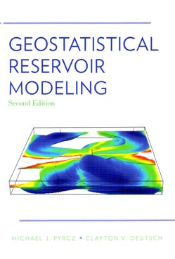
This book describes how geostatistical reservoir modelling can contribute to making informed decisions by building and using numerical geological models of petroleum reservoirs which include geostatistical considerations. Beautifully prepared and illustrated, it details the practice, tools and techniques, and focuses on concepts and some important algorithms and examples from real reservoirs to illustrate those techniques. It uses work flow-charts to summarise operations.
Actual programmes are not given, but there is a list of sources where they can be found. Emerging developments are identified and briefly described. A glossary of relevant geostatistical terms and notation is provided as is an excellent bibliography, which provides a valuable resource for deeper detail, theory or software. The bibliography shows that the authors are pioneers in the subject and have contributed significantly. Finally there is an index.
This book would be a beneficial read for the practitioner wanting to understand the geostatistical tools and their usage in modern commercial programmes. It would be a good advanced undergraduate or graduate class text on modern reservoir characterisation and statistical modelling.
Reviewed by Richard Dawe
GEOSTATISTICAL RESERVOIR MODELING - 2ND EDITION by MICHAEL J PYRCZ & CLAYTON V DEUTSCH Published by Oxford University Press, 2014, 433pp. ISBN 978-0-19-973144-2 List price: £64.00 hbk www.oup.com/uk