Product has been added to the basket

Smith field trip 2

John Strachey, William Smith, and the Strata of England, 1719-1801

William Smith in later life. A cast of Smith’s features 'taken years ago from the living subject’ by Joseph Baker of Scarborough. Smith died in 1839, before photographic portraiture was possible. Baker noted (1873) that 'original mould is destroy

Notes for field excursions to the birthplace of stratigraphy


Four Sites to Visit in the City of Bath


Motor vehicle access to the inner streets of Bath is generally inconvenient. Two sites, No.29 Great Pulteney Street and the corner house on Trim Street, are best approached on foot. Two other sites, Bloomfield Crescent and Batheaston, are more distant from the centre and are accessible by a compact vehicle. A street map marked with National Grid co-ordinates could be useful, for example the Ordnance Survey Bath City Map scaled at 1:10,000.

No.29, Great Pulteney Street

The whole length of this street (ST 754652) is part of the Bathwick development scheme commenced in 1788 by the architect Thomas Baldwin. The house numbered 29 became the Bath residence of one of Smith's supporters, the Revd Joseph Townsend (1739-1816), Rector of Pewsey, Wiltshire. He was a considerable author in medicine and cosmogony, ‘standing six foot six in his socks, with a voice to match’. His Character of Moses Established, which came out in 1813, is expensively sought today for its early printed version of Smith’s stratigraphy.

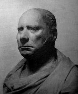
In 1926, a bronze plaque (Figure 1) was affixed to the house, inscribed with these words:

‘In this house William Smith the Father of English geology dictated the Order of the Strata December 11, 1799’

The date on the plaque should read June 11, 1799, not December 11. According to Benjamin Richardson (1758-1832), who was then present, Smith was in Bath for the annual meeting in June, 1799, of the Bath Agricultural Society; and the gathering at Townsend’s residence took place at that time, only a few weeks after the termination in April of Smith’s employment with the Somersetshire Coal Canal Company. 

Richardson had a high regard for Smith’s abilities, and was first among his mentors and advocates. It was Richardson who wrote out the Table of Strata from Smith’s dictation, and it was this manuscript in Richardson’s handwriting that Smith donated years later to the Geological Society of London. This Table (Figure 2), taken from John Phillips’s Memoirs of William Smith published in 1844, lists the twenty-three strata named in the original MS. According to Richardson’s recollection, after writing out the Table of Strata, additional copies were given away ‘in consequence of Mr. Smith's desire to make so valuable a discovery universally known’, which discovery, of course, was the special relationship found to exist between particular strata and particular fossils contained within them. Smith had already demonstrated the truth of this to Richardson and Townsend in the country south and west of Bath, notably at Dundry Hill. Smith’s perception of predictable sequences of identifiable strata enabled a more scientific approach to coal prospecting, which was then a focus of huge activity in pursuit of fuel to stoke the furnaces of industry and to fill the smoking millions of urban grates. Sinking and boring for coal at Batheaston provides an early example.

Bronze plaque attached to the wall of No. 29 Great Pulteney Street, the Bath residence in 1799 of Joseph Townsend. Photograph courtesy J.T. Greensmith.

Batheaston Coal Trial, 1804-1813

William Smith’s involvement in coal-exploration at Batheaston dates from 1804, while he was advising on remedial work for the City’s hot springs. The boring for coal at Batheaston was one of the first such prospects in Britain to be stratigraphically monitored, and has its own memorial in the name Coalpit Road, which branches off London Road at ST 7805 6743. The actual site of the borehole ‘believed to be substantially correct’ according to G.A. Kellaway, is at ST 7818 6774, on land within the present-day Elmhurst housing-estate.

Between 1791 and 1799 Smith had worked out the sequence of strata around Bath, enabling him, after leaving the Somersetshire Coal Canal Company, to apply his skill to subsurface exploration for coal, a stratum which he knew to occupy a determinate position in the local sequence. Knowing also of the strongly discordant relationship in this part of the country between the Red-ground (Triassic) and underlying coal-bearing strata (as illustrated by his copy of John Strachey’s cross-section) and the actualities of coal-workings barely three miles from Bath city-centre, at Newton St Loe, he could predict that coal might be found by sinking through Lias and Red-ground. This was the case at Batheaston, where his advice was sought, though one must add in Smith’s defence that the choice of the trial’s location had not been his.
 
Two masonry-lined shafts, each nine-feet in diameter were started, and encountered copious water-flow from the Lias. This water was walled off, and in 1808 Smith made a log of the strata penetrated down to that level; but in 1811, after the bottom-hole boring had entered Dolomitic Conglomerate or ‘Millstone’ (Triassic), a huge influx of water overwhelmed the pumps. Curiously, this water felt distinctly tepid, some thirteen degrees Fahrenheit above the ambient norm, and rumours flew about that Bath’s main asset, the hot springs, were being compromised.

At the corner of Trim Bridge and Trim Street, the former premises of Smith and Cruse, still in trade as Trim Bridge Galleries when this photograph was made. Smith was thus presented with a classic conflict of interest. He knew as a fact by 1811 that the rate of flow at the City’s hot-springs had been altered by the cataract at Batheaston, yet he was expected still to advise on the coal trial. Larger pumps could hardly cope with the water, and boring continued with great difficulty and expense, ending at a total depth of 671 feet, when the Company’s money ran out. The trial was abandoned. in 1813. Flowing water can still be seen emerging from an outfall at ST 77956775 on the west side of Coalpit Road, 260 yards ESE of the church of St John the Baptist (ST 7775 6790).

The barren strata immediately below the Triassic seem to have been sandstones formerly called Millstone Grit, in the uppermost part of the local Carboniferous Limestone sequence, and thus stratigraphically below any productive coal seams. The failure of this attempt to find coal at Batheaston was, of course, unpredictable, and only hindsight can allow a claim that the trial had been made for the right geological reasons, and ‘only just failed’ . More pertinently, one can be certain that the borehole site was not chosen by William Smith, but by Thomas Walters, owner of the land and mineral rights where the operations took place. 

Using similar knowledge of stratigraphic sequence, Smith was able to advise also at places where any success in coal-exploration would be virtually impossible. Such an opportunity first came about in 1805 at South Brewham, a Somerset village 18 miles south of Bath. On the evidence of fossil Gryphaea from a shaft already sunk to 120 feet depth in search of coal, Smith advised the operators that they were far too high in the stratigraphic sequence ever to reach their objective by boring, and that they had been misled from the beginning by the dark and ‘coaly’ appearance of local clunch soil (Oxford Clay).

Trim Bridge

This building (picture, above right) constructed in 1799 at the corner intersection of Trim Bridge and Trim Street (ST 74926489), though somewhat misidentified in the past by reason of altered house-numbering, was from 1802 to 1805 the office of William Smith and his land-surveying partner Jeremiah Cruse (1758-1819). Here, Smith's fossil collections were laid out in boxes arranged stratigraphically, and open to public view. At that time, Bath’s extraordinary social standing and popularity, its innumerable visitors from all walks of life - land owners, urban gentry, collectors of ‘cabinet curiosities' - meant this was one of the most effective ways by which Smith's practical results in the field of soil identity and agricultural improvement could be publicly advertised. Smith was at heart a man for whom a working demonstration was more effective than a printed publication.
Bloomfield Crescent: Middle house from a terrace formerly known as Cottage Crescent. Smith lived here 1795-8 while surveying for the Somerset Coal Canal Co. Photo: courtesy W H George

Bloomfield Crescent

In September or October of 1795, Smith moved from his lodgings at Rugborne Farm on the Jones estate, to the middle house (ST 73856291, Figure 4) in this terraced crescent of seven overlooking Bath from the road up to Odd Down. The entrance from Bloomfield Road opens to the rear of the Crescent, and residents may seek plausible explanations from visitors asking to see the front of the Crescent.

Construction of these houses, then called Cottage Crescent, began in 1794. Smith was here until 1798, supervising work on the Somersetshire Coal Canal. From the front of the Crescent looking northward residents enjoy spectacular views over Bath and the Avon valley. ‘From this point,’ wrote Smith, ‘the eye roved anxiously over the interesting expanse which extended before me ... then did a thousand thoughts occur to me respecting the geology of that and adjacent districts continually under my eye.’ He was already aware from excavation of the canal-bed that fossil occurrence varied from stratum to stratum, and that particular fossils could be associated with particular strata, though he had not yet embarked on any stratigraphic mapping beyond the area of a local publication entitled Map of 5 miles round the City of Bath. Smith ended his residence at the Crescent in 1798, when he purchased the house called Tucker Mill or Tucking Mill, near Midford, and much closer to his Coal Canal work..