Product has been added to the basket

Reviews - August 2008

Geology of the Llangranog District

1:50,000 Map Sheet 194 and Explanation
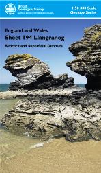
Llangarog district

J R Davies, T H Sheppard, R A Waters & D Wilson
Published by: BGS
Publication date: 2006
ISBN: 075183448-3 (map) and 978-085272566-5
List price: £18.00 for the pack
38 pp (booklet)


www.bgs.ac.uk

This map supersedes the one-inch maps by pioneer geologists including Aveline, de la Beche, Phillips and Ramsay, published between 1845 and 1857. So, a 150-year interval, but better late than never!

The map is one of several long-awaited sheets covering central and northern Wales, most of which have been produced recently by the excellent BGS team listed above (who wrote the handbook) as well as others who helped in the mapping. The solid geology ranges only from the late Ordovician (Ashgill) to the early Silurian (Llandovery) and consists almost entirely of deeper-water sediments, mainly turbidites, filling the subsiding Welsh basin. There is a notable absence of igneous rocks. The monotony was only broken during the latest Ordovician (Hirnantian) ice age, when the 500m thick Yr Allt Formation was deposited, which includes some spectacular slumped sandstones, including giant sandstone pillows that are well exposed on rather inaccessible coastal cliffs. Afterwards the monotony returned, but the area includes the southernmost parts of the classic Aberystwyth Grits turbidites in the region near Newquay. Inland, the solid rock exposure is rather poor, since the area was blanketed during the Pleistocene (chiefly Late Devensian) glaciations, when Irish Sea and Welsh ice sheets combined to cover the region, depositing glacial and fluvio-glacial sediments with pebbles from across a wide area. The economic importance of the district (apart from aquifers) lies in a single road aggregate quarry.

So, in summary, not one of the most exciting parts of the geology of Britain, which probably accounts for the prolonged lack of attention; but nevertheless BGS must be congratulated on achieving its usual very high standard of mapping. The accompanying booklet is sadly rather short, presumably reflecting the lack of economic interest, and is no substitute for the traditional Survey Memoir; but it is certainly better than nothing.

Robin Cocks
Department of Palaeontology
Natural History Museum


A Basic Guide to Air Photo Interpretation in Hong Kong

Hong Kong

H Y Ho, J P King & M I Wallace
Published by: Applied Geoscience Centre (ASC), University of Hong Kong
Publication date: 2006
ISBN: 10: 988-98896-1-7
List price: HK$200
115 pp


www.hku.hk/earthsci/agc

This book is one of a series of geoscience guides published by the ASC for use in Hong Kong. In his Foreword, Professor Malone states that its specific aim is to help address the problem that “…few of the people who might gain from the use of air photos will have received any training in API in their university education”. Those of us who work with aerial photographs can only look on with envy at the 80 years of photographic coverage available in Hong Kong. Through the work of (initially) the Geotechnical Control Office (GCO), and then the Geotechnical Engineering Office (GEO), this unique archive has been used magnificently. Nowhere in the world has API been used so effectively for investigating ground conditions as in Hong Kong, and this is superbly illustrated in this book.

In Chapters 2 and 3 the book contains descriptions of the basics of aerial photograph collection. Chapters 4 and 5 deal with API in Hong Kong, and although they are extremely well presented, they are mainly for companies and individuals who work in the area. Chapter 6, however, is a real gem that sets this book apart as an API guide. It contains examples of API studies, and while they are naturally all from Hong Kong, the observations and lessons that are brought out by the work provide guidance on how to undertake high quality API anywhere in the world. All the examples are accompanied by coloured maps and annotated aerial photographs with the API observations and key findings listed. I was particularly pleased to see Section 6.6 on Terrain Classification, which highlights just how innovative was the Geotechnical Area Studies Programme (GASP) that was undertaken between 1979 and 1989. I would also recommend anybody required to undertake an API of an area to look at Appendix A, which provides a classic example of the quality of output that can be achieved.

I have a few very minor criticisms, in that there are some annoying spelling mistakes and incorrect references. Also the photo gallery is variable in quality and would benefit from having annotated sketches that pick out salient features. However, overall this is a wonderfully well-written little book with superb illustrations, and one of the few published in many decades that gets down to actual interpretation of aerial photographs for engineering purposes.

Jim Griffiths
School of Earth, Ocean and Environmental Sciences
University of Plymouth
        

Yorkshire Rocks and Landscape - A Field Guide (3rd Edition)

Yorkshire

Colin Scrutton & John Powell (eds)

Published by: Yorkshire Geological Society

Publication date: 2006
ISBN: 10: 0950165662
List price: £9.99 plus £2.00 p&p
224 pp


www.yorksgeolsoc.org.uk

Having eagerly awaited the opportunity to review this delightful ramble through some of the best of Yorkshire’s hallowed geology, I was not disappointed. Reading it was like returning to some old friends, through memories of dim and distant fieldtrips and excursions. The book will attract and delight both enthusiastic amateurs and diehard professionals who enjoy the science for itself. It provides a broad coverage of Yorkshire’s geology and geography, although inevitably there will be some who are disappointed that their favourite excursion or a classic locality has been omitted. For example, I felt that it under represented South Yorkshire geology at the expense of the classical West and North, but this is a minor detraction in what is an enjoyable and thoroughly readable tome.

The book commences with an excellent introduction and summary of Yorkshire geology. It is also good to see field safety introduced early and dealt with in a comprehensive and professional manner. All of this sets the scene for 21 excursions that span the breadth and depth of Yorkshire geology. These are well laid out and cover all the facets of each area in a systematic and structured format. Each excursion is clear, informative and easy to follow, comprising a brief geological overview leading into a detailed guide. Simple maps and diagrams guide the reader through each ‘trip’. The list of authors provides a who’s who of Yorkshire geology - those well-known names and enthusiasts that have pounded the trails for many years; they are the foundation of the Yorkshire Geological Society.

All in all, this is a delightful book that easily fits the coat pocket and promises to be a valued friend to anyone that wishes to get to know Yorkshire geology for the first time, or to re-visit after years away. Do not read this if you are seeking challenge or an introduction to areas of controversy and debate. This is a well-designed promenade through some of the best of Yorkshire’s geology at reasonable price. A good job, well done - thanks again to the YGS.

Mike Bowman
BP Exploration
Houston