Stanage Edge, Peak District

Stanage Edge is one of the many prominent gritstone escarpments found in the Peak District in England. An area famous for climbing, the area was also quarried for grindstones. These rocks were formed in in vast river deltas that once covered the whole of the White Peak from the Roaches in the West to Kinder Scout in the north. The Peak District is dominated by a series of sedimentary rocks that formed 350 million years ago, in the Carboniferous Period. This sedimentary succession began with the deposition of limestone when the Peak District was submerged beneath a warm, shallow sea. Britain at that time was located on a palaeocontinent near to the equator, and the shallow sea abounded with life, with shellfish, crinoids and fish all living in vast coral reefs. It is in these conditions that limestone forms. Corals, shellfish, snails and eggs all have hard parts formed from calcium carbonate (CaCO3), a mineral which exists in solution in the oceans. Animals with hard shells and bones use dissolved CaCO3 in sea water to form their hard outer shells and bones. Where ocean life is abundant, the skeletal matter collects on the sea floor as organisms die and sink to the bottom of the water column. This accumulation of material creates limestone.
 |
|
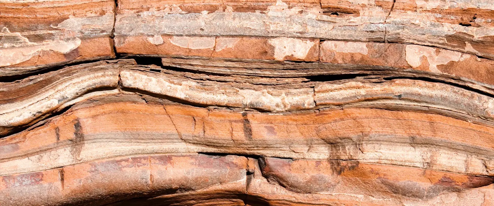
| Stanage Edge: © John Fielding |
During the Carboniferous, a supercontinent in the South made up of modern-day Africa, Australia, India and South America, Gondwana, was moving due to the activity of plate tectonics and passed close to the South Pole. This caused the build-up of a large continental ice sheet on Gondwana. The buildup of ice on the supercontinent reduced the amount of water in the oceans which caused a global drop in sea level. This change in sea level meant that the Peak District emerged from being underwater and exposed the sediments to erosion and weathering. Much of Britain became coastline rather than being submerged under a sea and rivers became the dominant source of sediment. During this time, large rivers from continental Scandinavia started depositing fluvial material on top of the limestone. The silt, sand and gravel that was being washed in by the large rivers was compressed and lithified (formed rock). This coarse grained sandstone is called millstone grit and this is what makes up the prominent landscape feature at Stanage Edge. It has been used to grind grain in mills for the last 2000 years and was exported across Northern Europe until the 18th century.
As sea levels dropped further in ancient Britain, plant matter began to grow in the warm, swampy, coastal regions but the fluctuations in sea level meant that this large quantity of plant matter was frequently submerged and buried by tidal sediment. These repetitions are called cyclothems and are the source of the coal, found above the millstone grit in the Peak District and surrounding areas.
 |
|
| A cross section of the Peak District showing approximate strcture of an eroded dome: © Schumi555 |
After this deposition, tectonic forces compressed this area of crust and the rocks responded by doming upwards. This is the result of the forces involved in the final stages of the formation of the supercontinent, Pangea. There was then further uplift and erosion of post-Carboniferous rock strata at the end of the Cretaceous (145 to 66 million years ago). This uplift and subsequent erosion has effectively sliced the top off the dome to reveal a concentric outcrop pattern. At the centre, the grit and shale has been eroded to expose the limestone layers but at the edge where Stanage Edge is located the grit is still intact and forming and escarpment above the limestone. These escarpments can still be seen at Stanage Edge, Derwent Edge, Windgather and others.
Twinned with: Ganges Delta
As with the gritstone escarpments found at Stanage Edge, the sediments found at the mouth of the Ganges and Brahmaputra rivers form vast river deltas of material washed off the nearby mountains. Except here, the sediments are washing off the modern-day Himalayas as opposed to the uplifted regions of Scandinavia that supplied ...continue reading
Related Links
- Dan McKenzie Archive
- The Rock Cycle
- Plate Tectonics schools website
- Plate Tectonics Glossary
- Lower Carboniferous (Mississippian)
Further Reading
| Back to main stories page > |
Other sites
- Twin: Windward Isles
Cwm Idwal
- Twin: Mount Pinatubo
Sperrin Mountains
- Twin: Sierra Nevada
Southern Uplands
- Twin: Nankai
Ben Arnaboll
- Twin: Glarus Thrust
Outer Isles
- Twin: Tohoku Earthquake
Clogherhead and Shannon
- Twin: Papua New Guinea
Cairngorms
- Twin: New Hampshire Granites
Great Glen Fault
- Twin: North Anatolian Fault
The Lizard
- Twin: Troodos Ophiolite
Yoredales
- Twin: Antarctica
Stanage Edge
- Twin: Ganges Delta
Hartland Quay
- Twin: Zagros Range
Amroth-Saundersfoot-Tenby
- Twin: Salt Range, Pakistan
Vale of Eden
- Twin: East African Rift Valley
Zechstein
- Twin: Sicily
Alderley Edge
- Twin: Navajo Sandstone
Isle of Skye
- Twin: Mount Kilimanjaro
Lulworth Cove
- Twin: Albania
Giant's Causeway
- Twin: Cascade du Ray Pic