By the sea, Kent
During the last Ice Age, evidence from around the world shows that sea levels were much lower than today, because vast amounts of water were trapped on land as ice sheets. These covered northern parts of continents including northern Britain - you could have walked from England to France on dry land then!
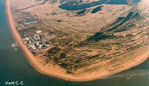
About 10,000 years ago, the ice melted and sea levels began to rise. Shingle, washed up by storm waves, was swept ever further inland as the sea advanced. The shingle bank that now forms the Dungeness headland has been gradually pushed eastward by waves, driven up the English Channel by south-westerly winds, a process called longshore drift. The bank now shelters a former bay where Romney Marsh has been reclaimed from tidal flats.
The natural process of shingle movement has recently been altered by recycling it from east to west using bulldozers and lorries, in order to protect the nuclear power station seen on the left of the picture.
Dungeness, Kent