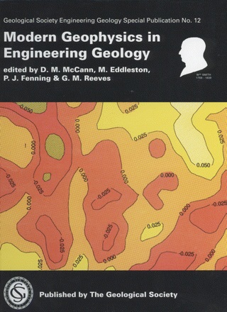
Modern Geophysics In Engineering Geology
Product code: SPE12
Print publication date: 28/11/1997
Earth Resources and Economic Geology, Engineering Geology, Geophysics and Geophysical Applications, GSL Engineering Geology Special Publications, Geological Society of London
Binding: Hardback
ISBN: 9781897799925
Author/Edited by: D. M. McCann, M. Eddleston, P. J. Fenning and G. M. Reeves
Weight: 1.33kg
Number of pages: 302
Lyell Collection URL: https://www.lyellcollection.org/toc/egsp/12/1
£95.00
Log in for your member priceFull Description
Product Code: SPE12
D. M. McCann, M. Eddleston, P. J. Fenning and G. M. Reeves
Engineering Geology Special Publication 12
*** Limited stocks remaining
Geophysical surveying methods play an important role in the site investigation process. During the past decade considerable progress has been made in the development of geophysical equipment incorporating microprocessors and data loggers. This has been accompanied by corresponding advances in the computer software available to process, interpret and display the geophysical data obtained in a survey.The selection of a geophysical method for use in a specific geological environment requires close collaboration between the geophysicist and the civil engineer and engineering geologist. In this book many examples of the successful integration of geophysical surveys into the site investigation process are described. The authors are drawn from many different countries and the case histories presented clearly indicate the importance of geophysical methods in the construction history in a world-wide context.
Available on the Lyell Collection http://egsp.lyellcollection.org/content/12/1
Preface;
Acknowledgements
Section 1, Introduction: Setting the standard for geophysical surveys in site investigation; Section 2, Standards and Practice: Electrical imaging and its application in engineering investigations;
Novel regularized inversion of VLF(R) data and coincident radar sections over a probable fault affecting Carboniferous sedimentary rocks in the Saar region, Germany;
Geotechnical applications of the spectral analysis of surface waves; Imaging groundwater ‘steps’ in push moraines by georadar;
Some improvements in the processing of borehole acoustic signals for the characterization of geological structures;
Resistivity (-method) method for environmental monitoring: a new approach; The use of Rayleigh waves to detect the depth of shallow landfill;
The application of electromagnetic techniques to environmental geophysical surveys; The geotechnical value of ground stiffness determined using seismic methods; Multicomponent geophysical surveys over completed landfill sites;
Section 3, Site investigation: An example of the use of crosshole tomography in dam well foundation studies;
The detection of cavities using the microgravity technique: case histories from mining and karstic environments;
Radar tomography applied to foundation design in a karstic environment; Seismic tomography survey under the La Gileppe Dam;
Application of the micro-gravity technique to cavity location in investigations for major civil engineering works;
Contribution of electrical and acoustic methods in the evaluation of the condition of accessible underground pipework and its environment;
Resistivity sounding: two case studies from the Creatceous Chalk at Boxgrove, West Sussex and Barnham, Suffolk, UK;
The potential of on-shore high-resolution shallow seismic techniques when applied to coastal site investigation;
The use of geophysics in the design and construction of the new airport at Chek Lap Kok, Hong Kong; Electrical resistivity imaging systems for ground investigations, with particular reference to dissolution features in Chalk areas;
Cross-hole seismic tomography for engineering site investigation;
Section 4, Rock mass assessment: Hydraulic tomography in fractured bedrock aquifers using high-resolution borehole flowmeter measurements;
Azimuthal resistivity and seismic measurements for the determination of fracture orientations;
Downhole geophysical investigations for a proposed deep highway cutting adjacent to a rail tunnel at Murrurundi, NSW, Australia; Shallow over-water seismic reflection surveys for determining inland waterways sediment distribution in the Netherlands;
The acquisition of geophysical wireline logging data as part of the UK Nirex Ltd investigations of a potential radioactive waste repository at Sellafield, Cumbria;
Integrated study of fracture systems in Southern Zimbabwe; Surface and borehole microseismic monitoring of mining-induced seismicity;
High-definition seismic for Channel Tunnel marine route; Geophysical survey planning for the Dounreay and Sellafield geological investigations;
Section 5, Laboratory studies: The use of shear wave transmission as a non-destructive tool to assess the soft soil stiffness in dredging applications; Thermal conductivities of agrillaceous sediments; Measurement of stiffness of soils using small strain triaxial testing and bender elements; The use of ultrasonics to monitor long-term creep tests of salt rock samples;
Section 6, Advances in the seismic refraction method: Seismic refraction in relation to geotechnical information for (road) construction contracts; A new standard in the practice of engineering seismic refraction; A flexible algorithm for seismic refraction interpretation using program REFRACT;
Seismic reflection survey in Bernburg, Germany: an application of the generalized reciprocal and phantoming methods; Evaluation of seismic refraction interpretation using first arrival raytracing;
Section 7, Summary and Conclusions: Engineering and environmental geophysics: the future; Modern geophysics in engineering geology: an overview;
Index


