Kilve
Somerset, England
When oil explorationists started to develop the hydrocarbon resources of the North Sea they quickly realized that many oil fields were located on top of fault blocks. Understanding the geometry of these faults became important for predicting the extent of oil fields, at a time when seismic data were not of the quality of today!
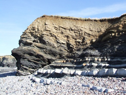
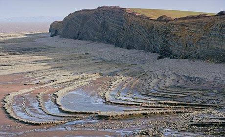
To help it became important to find small-scale outcrop analogues for fault structures, to test ideas of how faults join, their displacement and continuity characteristics. The faults at Kilve, developed in Jurassic strata on the southern shores of the Bristol Channel became critical.
It was here that many ideas of fault geometry were built and tested. The bedding planes exposed on the foreshore offer quasi-3D outcrops of fault offsets and relay ramps on the metre-scale.
Even today the area is heavily used by students and industry professionals to enhance their own knowledge of fault systems. And the ideas on normal faults have been exported around the world.
Text: Professor Rob Butler
Related Links
Further reading
Peacock, D. & Sanderson, D. 1991. Displacements, segment linkage and relay ramps in normal fault zones. J. Struct. Geol. 13, 721-733.- An excellent introduction to the Kilve outcrops.
Images (top to bottom):
- Fold at Kilve Bay ©Tony Howell
- Rocks offset by fault line © Rob Farrow (Source Geograph.org.uk) Creative Commons Attribution-ShareAlike 2.0 license.
![]()
October 13 - 21
Theme: 'Earth Science in our lives'