Glaciation in Britain
Much of Britain was covered by ice during several “Ice Ages” over the last 500,000 years. The most recent one ended only 10,000 years ago. Glaciers and ice sheets scoured the landscape, wearing away the rocks to form glacial landscapes in the Scottish Highlands, Lake District and N. Wales. In the coldest periods, the ice would have been hundreds of metres thick, and reached as far south as London. Material eroded by the ice was left behind as the glaciers retreated, forming Boulder Clay (till) deposits that cover many parts of eastern England.
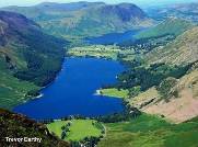 Ribbon lakes formed by glacial erosion, Buttermere, Lake District.
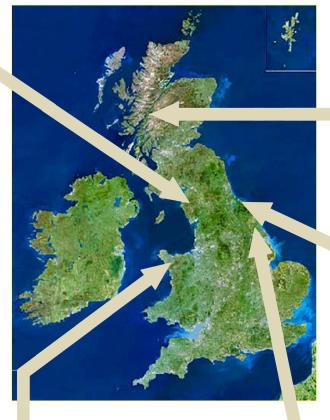
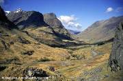 U-shaped glacial valley, Glencoe, Scotland.
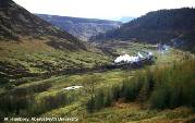 Newtondale, Yorkshire, formed rapidly by glacial meltwater.
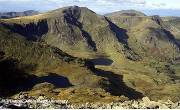 Cirques (Cwms) formed from snow hollows at glacier head, Snowdonia.
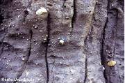 Boulder clay laid down by ice sheets in much of eastern England.