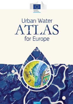
What has Europe ever done for us? Well, for a start it has produced this fantastic atlas. At 420mm x 300mm this isn’t an atlas that will sit neatly on a shelf at home, or even on a coffee table, but it would be a valuable addition to a university, institution or company library.
This is not just an atlas of facts and figures, this is so much more than that, to paraphrase a Rowan Atkinson line. The atlas combines the presentation of the best practice in urban water management across Europe with contemporary art. As such, and in the words of Prof. Jose Manuel Prado Pozuelo “the atlas is a fine example of an initiative which has embraced the joint talents of scientists, researchers, political analysts, artists and children.”
The importance of water is so often understated—particularly in the urban environment. Water management, collection and distribution is a rural thing, a thing of mountains and reservoirs, lakes and wellfields. This atlas brings us back down to reality. Urban water management is what keeps our populations going. In order to quench the thirst of our cities, water needs to be managed intelligently, and certainly more intelligently than is done at present.
And this message comes across loud and clear. The atlas takes us through the background of the urban water cycle, covers topics such as governance, storm water management, energy recovery, distribution, reuse & recycling, water footprinting, and includes a fantastic section called “Water’s Collective Memory”. We are led through easy-to-read text, beautiful figures, diagrams, photographs and art, at an appropriate level of understanding and including the data that lie behind them.
We step through 39 cities, including London and Bristol, on which a standardised set of data and statistics is provided, covering topics such as water demand and availability, management of water resources (City Blueprint), flood risk, trends and pressures, drought and water footprinting. 4 pages are devoted to explaining how the data sets and infographics can be interpreted, the explanations written for a general audience without being patronising or dumbing down the science.
Each city section covers 2 pages and because the infographics and charts are laid out in the same place on each page across the cities, it is very easy to compare and contrast data sets. Again, written and presented in clear language and graphics makes understanding particularly straightforward.
What comes out clearly is the fact that European cities are at the heart of forward thinking policies and practices that act to conserve, protect and reuse water. While urban planning at national, regional and local levels needs to grapple with the challenges of practical implementation, this atlas shows what is possible and why it is needed.
While the Urban Water Atlas for Europe may not be a book for the home, it is without a doubt an essential reference for anyone interested or working in water management, from Earth scientists to civil engineers, economists to social scientists.
Reviewed by James Dodds
URBAN WATER ATLAS FOR EUROPE by Gawlik, B.M., Easton, P., Koop, S., Van Leeuwen, K., Elelman, R., (eds.), 2017. Published by: European Commission, Publications Office of the European Union, Luxembourg, 160 pp. ISBN: 978-92-79-63050-7.
List Price: €25.00
W: http://bookshop.europa.eu/