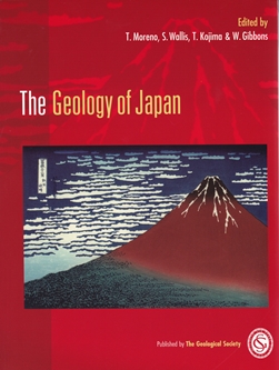
 Given the wealth of geological research emanating from the Japanese Islands, it is surprising that this is the first large format English language overview for 25 years of the remarkable insights which have been obtained during this time. Coupled with belts of active volcanism, the whole nation is prone to massive earthquakes, tsunamis, and often rapid rates of erosion and ground deformation which has encouraged further systematic studies, right back to drilling 797 ground investigation boreholes after the 1923 Great Kanto Earthquake that devastated Tokyo and Yokohama. Though most of Japan is divided between the Eurasian and North American plates, it is also impinged upon by the subducting Izu-Ogasawara arc along the northern edge of the Philippine Sea Plate in turn being subducted by the Pacific Plate, which also passes directly under northern Honshu, Hokkaido and the Kuril Arc.
Naturally this requires a curtain-raising overview chapter which like many of the others includes some impressive colour graphics and geophysical maps of the Philippine Sea obtained as part of Japan's preparations for legal claims to continental shelf extending beyond 200 nautical miles. Then a series of chapters details the regional tectonostratigraphy of the islands, including the Palaeozoic basement, accretionary complexes and paired metamorphic belts - before a couple on the two main island arcs. Kyushu-Ryukyu extends over 1000km southwestwards towards Taiwan, while Izu-Bonin stretches from the Izu Peninsula near Tokyo for 2800km to Guam. The first of these does an incredible job illustrating the sheer diversity of earlier rock types thrown together by Cenozoic plate convergence through to ongoing Quaternary volcanism, while the latter reproduces some amazing seismic profiles.
A third of Hokkaido belongs to the Kuril Arc and concludes this section before the more thematic chapters. There are thoroughgoing accounts of the distribution of Ophiolites, Granitic rocks, and Miocene to Holocene volcanism with beautifully crisp black-and-white topographic images and photographs, including several impressive calderas. The deep seismic structure chapter is truly outstanding, including whole-mantle tomography plus numerous other profiles and contoured maps showing depths of both subducting slabs beneath Japan. Then a crustal earthquakes chapter continues this theme, with illustrations of active faults, surface ruptures and 30-year probability zones.
Though coastal geology and oceanography is surprisingly concise, it includes an account of mining-induced subsidence and tsunami deposits: enough to confirm the 1:50,000 geological map covering Fukushima Daiichi, which made no reference to them long before these nuclear reactors were overwhelmed in March 2011. The final chapters outline Mineral and Hydrocarbon resources, engineering geology including landslides, and a guide for potential visitors including parks and museums. One notable omission is any mention of very limited glaciation, more general environmental conditions and the offshore extent of land during these Quaternary stages. Another is any glossary of common geological terms alongside each chapter, including a guide to Kanji and Hiragana translations for names. Overall, the editors must be congratulated for bringing together the work of over 70 researchers to produce this magnificent volume.
Reviewed by David Nowell
Reference
Geological Survey of Japan 1994. Geology of the Namie and Iwaki-Tomioka district 1:50,000 quadrangle series Niigata (7) No.46 and 47 sheet.
THE GEOLOGY OF JAPAN by T MORENO, S WALLIS, T KOJIMA AND W GIBBONS Published by: Geological Society of London Publication date: 2016 ISBN: 978-1-86239-743-9 List Price £50, GSL members £37·50 other societies £37·50 xiii + 522pp Hardback £100, GSL members £50, other societies £60 www. geolsoc.org.uk/bookshop