Nouvelle Série Bleue 1:25,000 topographic maps
 In a radical move the IGN has started publishing 1:25,000 maps spanning more than twice the area of the sheets they are replacing. These pairs of maps also indexed with two figure numbers from west to east and north to south to coincide with the 1:50,000 series used by the BRGM for its geological maps. In stark contrast to Britain, while this series of 1127 sheets is nearing completion, the BRGM intend to continue producing further revised and remapped editions. Though the IGN have developed a really innovative geoportail website and regional Georando disks with preloaded 25k mapping and aerial photography, which convert into slightly low resolution 3D models, printed maps are not being neglected.
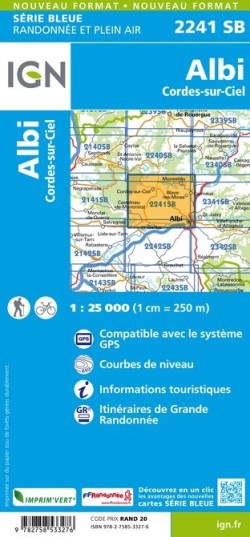
Though this paper size has been used for tourist areas, much of France has depended on sheet lines based on the Paris meridian. Rather than covering 280 km2 these new sheets, twelve folds wide (132 cm) with a main black fold for easy handling, will cover 685 km2 with a complete series of overlaps. Though these are as little as 250 m in the east-west direction, beyond this the margins of these maps have neatly faded cartography right to the very edge. While these margins number two independent kilometre grids and show latitude and longitude intersections, they omit hundredths of a degree relative to Paris, as the elongated half sheets were exactly 20 by 20 gr, like older maps which all refer to this meridian. However, there is some welcome flexibility, so locally whole rows of sheets can be pushed sideways by a good kilometre, allowing the whole of Albi to fall on one sheet (22 41 SB) rather than its outskirts straddling four sheets.
Unfortunately some symbols found on the 100k series are omitted from the trilingual key which contains a number of mistakes: an avalanche shelter becomes a “protective flagstone” covering a section of road, while a chemin rural is usually at best a cart track. Though the slightly simplified cartography will continue to show intertidal contours and levels within quarries, field boundaries not connected to delimiting vegetation have been stripped out. Fieldwork will thus either have to fall back on using aerial photography printed out at home or carefully plotting GPS readings. However, these are minor flaws compared to the Ordnance Survey, whose response to my Soapbox article (sent via my MP) was to claim it was impossible to produce a third series of overlapping 50k sheets printed on a larger paper size.
Reviewed by David Nowell
NOUVELLE SÉRIE BLEUE 1:25,000 TOPOGRAPHIC MAPS
(French national IGN topographic series) Published by: Institut National de L’Information Géographique et Forestière W: http://ign.fr/ W: http://loisirs.ign.fr/thematique/nouvelles-serie-bleue.html Publication date: 2014 onwards to 2018. List Price €11·70 (each)