Product has been added to the basket

Reviews - March 2008

Field Hydrogeology (Third Edition)
The Geological Field Guide Series

Brassington

Rick Brassington
Published by: John Wiley
Publication date: 2006
ISBN: 10-0470018283
List price: £24.95
264 pp

www.wiley.com

I am a longstanding fan of all editions of Rick Brassington’s Field Hydrogeology, and have recommended it to many a student as a great book to read from cover to cover to gain an appreciation of the most practical and, in my opinion, most essential aspects of hydrogeology.

This edition includes the usual clear diagrams and interesting, well-written text. The book covers the essentials of field equipment, all the practicalities of fieldwork, field measurement and sampling of groundwater and surface water, plus a new section on pumping test analysis and falling head tests. Useful tables and charts are provided throughout.

New features include an excellent section on developing a conceptual model, complete with a very clear flow chart describing sources of information and required actions. There is even a suggested contents list for a hydrogeological report! In addition, there are four detailed UK case histories, each covering up to three pages and involving interpretation of groundwater strikes, geophysical down-hole logging and tracer tests, and contaminated groundwater investigations.

All in all this Third Edition represents a timely update for all hydrogeologists working in the field, and for those working at the computer all day who need to gain an understanding/reminder of life in the field. It will also be a useful read for geotechnical engineers enabling them to gain an appreciation of hydrogeology. Those new to the subject, such as students, will gain meaningful appreciation and practical understanding of hydrogeology, while the more experienced will refer to the tables and reminders of less well-known techniques, such as surface water flow measurement. My only gripe is the new pocket size format that results in the use of a smaller type face.

I strongly recommend reading this book from cover to cover next time you have a long train or plane journey. Thanks to Rick Brassington there will be a lot more practical hydrogeologists out there.

Rebecca Exley
Cowbridge, Cardiff


Postcollisional Tectonics and Magmatism in the Mediterranean Region and Asia
Geological Society of America, Special Paper 409

SPE

Yildirim Dilek & Spyros Pavlides
Published by: The Geological Society of America
Publication date: 2006
ISBN: 978-0-8137-2409-6
List price: £132.00; GSL Fellow price: £92.40
644 pp

www.geosociety.org

This volume of collected papers arose from the Fifth International Symposium on Eastern Mediterranean Geology (Thessaloniki, Greece, 2004) and is the second of such contributions to have come out of that conference (Robertson & Mountrakis, 2006). It seeks to bring together a multidisciplinary set of papers investigating the collisional and postcollisional geology of the Mediterranean and Asia. This is achieved through the assemblage of 28 papers covering a huge range of topics, including: geodynamics, palaeomagnetism, neotectonics and igneous geochemistry. The volume’s geographical scope encompasses the whole of the Eastern Mediterranean from Apulia to Turkey, taking in Bulgaria and Greece on the way and extending eastwards to the Caucasus, Iran and Tibet.

The papers are a mixture of original research and reviews, and although the standard of all the contributing papers is good, several thought-provoking works on the regional tectonics stand out. Mantovani et al, present a new view on the effect the indentation of Arabia has had on the Eastern Mediterranean, while Dhont et al question whether the current view of Anatolian escape tectonics is valid. Further west, the focus of Corti et al is on the Sicily Channel, where their new data have implications for plate tectonic theory as they suggest that plate boundaries are entirely passive features.

The review papers of Mountrakis (Tertiary and Quaternary tectonics of Greece), Altunkaynak and Dilek (volcanism in Anatolia), Piper et al (Palaeomagnetic analysis of Anatolian neotectonics) and Allen et al (Contrasting collisional styles in Eurasia) are also well written syntheses that should end up on undergraduate reading lists.

The liberal use of colour throughout the volume adds to the overall high standard of the publication, and my only criticism is that some of the longer papers could have been shortened to increase their impact and reduce the size of the volume - at 1.8kg it is rather weighty! On the whole, however, this fine volume provides a valuable synthesis of recent research that will be of value to all students of the Eastern Mediterranean, from final year undergraduates to the most distinguished professor, as well as being of use to a wider audience interested in key geological processes.

Sarah Boulton
SEOES, University of Plymouth

Reference:

Robertson, A. H. F. & Mountrakis, D. (eds) 2006. Tectonic Development of the Eastern Mediterranean Region. Geological Society, London, Special Publication, 260.


Geology of the Newbury District – A Brief Explanation of 1:50,000 Geological Map Sheet 267

BGS

D T Aldiss, A J Newell, N J P Smith & M A Woods
Published by: British Geological Survey
Publication date: 2006
ISBN: 085272533-7 (explanation); 075183454-8 (map)
List price: £18.00
34 pp

www.bgs.ac.uk

The new map sheet and explanation is a very welcome and long overdue update of the 1898 (Hungerford) map sheet and 1907 memoir, and is the result of a new 2000-2003 survey.

The district contrasts rolling, grass covered chalk downs, with wooded hills and alluvial terraces and floodplains. The profusion of flints as building stones, the flint gravel washed across the highways and byways by springs and rainwater, the white Cretaceous chalk mud that glues itself to boots and walking shoes on the ‘downs’, and the gravely and pebbly Palaeogene sands of the wooded ‘commons’ define the nature of the geology.

It comes as a surprise then to find a map of Chalk downland with a stratigraphic column going down through the Quaternary, Tertiary and Cretaceous sediments into the unseen Triassic, Carboniferous, Devonian and even the Lower Palaeozoic. In the last 100 years not only have there been Tertiary and Cretaceous stratigraphic revisions, but also a wealth of new direct (borehole) and indirect (reflection seismic, magnetic and gravity) data to advance understanding of southern England deep geology. Map sections are projected over 2kms downhole and explanations given based on geophysical responses and deep drilling of the buried Berkshire Coal Basin, Lower Palaeozoic volcanics, south dipping Variscan thrust ramps and Westphalian basalts and microgabbros.

It is almost an anticlimax to reach Page 8 of the explanation and read about the familiar outcropping sediments actually seen around the district. Even here life has become more complicated, but no less interesting, as revised stratigraphic terminologies and descriptions are presented for the Cretaceous Chalk Group, which directly underlies most of the map sheet, and the overlying Tertiary and Quaternary sediments. The sub-Palaeogene residual clay-with-flints (much disliked by local gardeners!), the Quaternary periglacial head (solifluction) deposits and nine alluvial terraces complete the superficial geology.

Past mineral extraction has been limited to various chalk resources, flints for building and clay and sand for brick and tile manufacture. The peaceful rural setting is challenged only by the effects on newly constructed homes of instability of backfilled chalk pits, chalk solution and the slumping of water saturated Tertiary sediments.

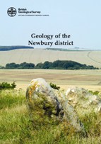
Map and explanation front covers show a very typical view of the area, with downland minus the crop circles, but with silicified Palaeogene ‘sarsen’ sandstones much used in the Neolithic stone circles. The authors have succeeded admirably in producing a very informative and well illustrated summary to a long awaited and equally informative map with sections.

Chris Carlon