Organised by:
Southern Wales Regional Group, William Smith Bicentenary
Venue:
Cardiff University, ROOM 1.25 Main Building, Park Place, Cardiff CF10 3AT
Event status:
EVENT CLOSED
Lecture Overview:
Time: 6:00pm for 6:30pm
Speaker: Dr Tom Sharpe
Tom is one of the best know authorities on William Smith and we are delighted he will be speaking to us about ‘the map’.
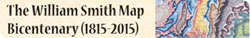
William Smith’s 1815 map A Delineation of the Strata of England and Wales, with part of Scotland, is rightly regarded today as an icon of geology. On a scale of five miles to one inch, it was a remarkable achievement for one man, working singlehandedly, with no official support or sponsorship, and outside of the developing formal structure of the new science in the shape of the recently-founded Geological Society. Smith’s map was based on principles which he himself had developed during the course of his work in Somerset in the 1790s, namely that the strata of southern Britain are arranged in a regular sequence, and that particular strata can be identified and correlated on the basis of the fossils they contain. As a mineral surveyor, Smith was aware of futile coal searches being undertaken in parts of the sequence well above or below the Coal Measures by unscrupulous surveyors or by those who were misled by the similarity of some strata to those associated with coal. With the stratigraphy shown on his map, Smith aimed to give landowners an indication of whether coal was likely to be found on their property, and he was careful to include many estates and country seats on his topographical base map. The 410 subscribers to his map included 2 dukes, 5 marquesses, 13 earls, 2 viscounts, 14 lords and 21 baronets as well as at least 32 Members of Parliament, including the Chancellor of the Exchequer.
But Smith’s success was to be short-lived. Within five years, his pioneering geological map was eclipsed by a more detailed map, a collaborative effort by the members of the Geological Society under its first President, George Bellas Greenough. The similarities between the Geological Society’s map and that of Smith’s did not go unnoticed by Smith’s friends.
During the course of its production, Smith’s map was continually revised as new information became available to him, and at least six different issues can be recognised, the last dating from the 1830s. The map was accompanied by a Memoir, and Smith went on to publish a set of cross sections and a series of more detailed county geological maps, as well as two books on fossils and strata. Smith is commemorated on many plaques as ‘The Father of English Geology’, the title bestowed on him by Adam Sedgwick in 1831; he can equally be regarded as the Father of Stratigraphy.
In 2015 the bicentenary of publication of Smith’s great map will be marked by an international conference at the Geological Society of London, exhibitions, and other events around the country.
More events celebrating the Bicentenary of William Smith's map