Tertiary Volcanic Province
Location of the major intrusive centres
of the British Tertiary Volcanic Province.
Ar=Arran, M=Mull, A=Ardnamurchan,
R=Rum, S=Skye.
Pangea began to break up during the Jurassic period, and Britain drifted north on the Eurasian plate. Between 50 and 60 million years ago, the Atlantic Ocean began to form, separating Scotland and North America. The event caused large scale volcanic activity in the UK.
Image: From 'Location of the major intrusive centres of the British Tertiary Igneous Province', Journal of the Geological Society.
Evidence in the UK
The stretching of the crust as the Atlantic Ocean formed created weaknesses in the surface of the rock, at right angles to the direction of tension. Lava rising up through the cracks formed vertical sheet intrusions – known as dykes – across northern England, southern Scotland and the Inner Hebrides.
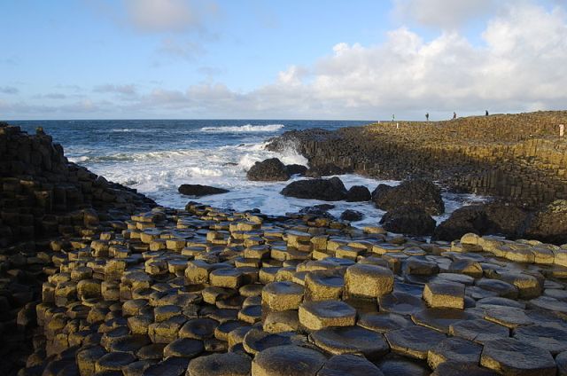
If they reached the surface, these formed fissure eruptions, covering large areas of land with lava. This produces a feature known as a ‘flood basalt’. These cover most of Skye, Mull and Northern Ireland. The Giant’s Causeway in Northern Ireland, and Fingal’s Cave on the Isle of Staffa, are well known examples. These basalts are famous for their hexagonal columns. This is an effect of the cooling of the lava, which in the same way as mud cracks form, has led to joints that reach down towards the centre of the flow and produces columns.
Some of the volcanic activity was explosive, leaving behind accumulations of large blocks of volcanic material (agglomerates) and ashes. These can be seen in Ballymena in County Antrim (Northern Ireland).
The Giant's Causeway