The landscape of the Burren has been shaped by geological forces for hundreds of millions of years. The story begins in a tranquil tropical sea near the equator, includes the development of a major river delta, migration and collision of continents, the expansion and contraction of the polar ice caps and last but not least, the rain that sweeps in from the Atlantic.
The rocks that make up the Burren were all formed during the Carboniferous period between 340 and 315 million years ago. This geological period is named for all the coal deposits in North America, UK and Europe that were formed at this time.
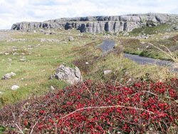
In the Burren are there are two major rock types; the lighter coloured limestones to the north and east and the darker siltstones, shales and sandstones to the south west. The limestones which make up the typical bare Burren landscape were buried by the slightly younger siltstones and sandstones which make up the Cliffs of Moher.
The different rock types were formed under different conditions; the limestones, which contain fossil corals, crinoids and brachiopods were formed in a warm tropical sea near the equator, very much like the Bahamas today. The limestones were deposited slowly over a very long period of time, around 20 million years and much of the rock is actually made up of little bits of broken fossils.
Continental Collision and Ice Age
Shortly after these rocks were formed the entire continent collided with what is now Europe, this caused the rocks ,which were originally horizontal, to become gently folded as we can see at Mullaghmore, in fact all the rocks of the Burren are tilted slightly to the south. The enormous forces that caused the folding are also responsible for the many cracks and fissures the run through the limestone now.
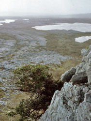
Much later, only about 1.8 million years ago the ice age started. Huge masses of ice over 200m thick came from the north and north east and scoured the surface ripping up soil and rock and carving valleys and then depositing the rocks and clay as the ice melted.
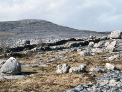
We can see these rocks scattered across the Burren as glacial erratics today. Along the coast there are many rocky beaches where it is possible to find rocks which are not originally from the Burren, these granites, red sandstones and others were carried by the ice from Connemara and east Clare and have been eroded by the sea from the glacial deposits left by the ice.
The last Ice age ended around 12,000 years ago. Since then the rain has been quietly dissolving the limestone and widening the fissures and also forming many of the caves we see all through the Burren. The rain continues to slowly dissolve the limestone today. The combination of features formed by rain and ice are known as a glaciokarst landscape and the Burren is a globally significant example which was awarded Geopark status in 2011.
Text courtesy of the Burren and Cliffs of Moher Geopark
Nominated by: Earth Science Ireland, William Sallun Filho