200 years of Geomodelling: The International Association for Mathematical Geosciences (IAMG) commemorates William Smith and 200 years of geomodelling with the Geological Society London
By Jennifer McKinley, Helmut Schaeben, Carl Watson and Martin Nayembil*
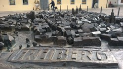 The International Association for Mathematical Geosciences (IAMG) commemorated William Smith (23rd March 1769 - 28th August 1839) and 200 years of geomodelling with geological surveys and academics across the globe at the 17th annual conference of the IAMG in Freiberg, Germany from the 5th to 13th September 2015. The aim of the IAMG is to promote the use of mathematics, statistics and geoinformatics in the geosciences. The annual IAMG conference is an opportunity for geoscientists to collaborate with mathematicians and statisticians and present their recent work. The
17th annual IAMG conference, with 300 participants from across the world, differed from previous IAMG conferences in that it included a special ‘Day of Surveys’ to acknowledge 200 years of science and methodologies to construct maps.
The local organising committee (chaired by Professor Helmut Schaeben, Dr Raimon Tolosanna Delgado and Professor K. Gerald van den Boogaart) and the IAMG strategic steering committee welcomed Geological Society of London sponsorship for this session. Representatives of geological surveys from different parts of the world were invited to exchange new developments, theories and concepts about 3D modelling.
Speakers from across Germany, France, Switzerland, Denmark, the Netherlands, China and the UK, presented their recent work in digital geomodelling techniques and communicating state of the art geological data models. Topics included 3D structure modelling; the issue of map projection; static and dynamic modelling; building folded stratigraphic horizons in geomodelling; uncertainty identification; the concept of fractal density in geomodelling; tetrahedral and voxel modelling approaches, data models and data architectures that support modelling and knowledge driven approaches for urban modelling.
The day began with a keynote address by Ian Jackson, former Chief of Operations and Director of Information at the British Geological Survey. In recognising the revolutionary role that William Smith’s extraordinary map, published two centuries ago, has played in geological science. Ian reminded us that Smith produced maps to provide a practical economic benefit and emphasised the role of geological surveys to produce maps for geological interpretation. Since Smith’s first map in 1815 there has been a considerable change in technology and printing.
Jackson described how geologists have 3D models in their heads. He reminded us that the Abington sheet was the ‘first digital map’ but it wasn’t until the late 1980s and 1990s that geological surveys started to embrace geographical information systems (GIS) and develop database approaches to managing and delivering geoscientific information.
The question posed was how are geologists now exploiting digital technology? The use of GIS for spatial analysis and presentation of the data has enabled an increasingly professional approach to data management. 2D maps are no longer sufficient with 3D models frequently used and developments towards 4D to represent time varying processes. Huge amount of progress has been made. Now vast areas of the world have been mapped with increasing resolution and sophistication. There is now widespread and innovative use of technology. Jackson’s concluding remarks asked how much progress have we made and what is the broader world’s view of us, as geologists, geoscientists and geomodellers?
The IAMG’s response to this challenge was to invite geological surveys across Europe and internationally to engage in a session on Communicating Digital Geomodels- methodologies and challenges as part of the Day of the Surveys. Presentations covered topics as broad as updating geomodels, knowledge-driven and data driven gemodelling, event-based geomodelling, accessing and reducing 3D structural uncertainty, validation strategies, querying and interacting with geomodels and interoperability. The Geological Society of London funded contribution was presented by Carl Watson from the British Geological Survey.
Carl explored integrating commercially generated data into centralised geoscience data repositories for the benefit of urban environments a topic he champions as part of the COST action Sub-Urban, a European network of Geological Surveys, Cities and Research Partners working together to improve how we manage the ground beneath our cities. The role of data modelling in a modern Geological Survey was explored by Martin Nayembil.
Martin presented the case of BGS’s development of data models, vocabularies… for its diverse geoscience information required for spatial visualisation and geomodelling and the development of a flexible and robust data architecture to support its scientific research and the creation of geoscience products and services.
As an effort to bring together both scientific and business endeavours to meet these challenges, the IAMG invited companies producing 3D geomodelling and mining software to present and exhibit their latest achievements to a public audience. Companies participating were Geovariances, GeoVisionary, GiGa Infosystems, Midland Valley, Mira Geoscience, and Rasdaman.
So what are the future opportunities? Jackson’s challenge was to improve at sharing our ideas and knowledge, engaging with the world at large to avoid the risk of the geological community losing relevance and economic support. In short we need story tellers as well as researchers to allow practical geology to enrich society.
Authors*
- Jennifer McKinley, Senior lecturer, School of Geography, Archaeology and Palaeoecology, Queen's University Belfast, Geological Society of London Council Member, Executive Vice-Presiden, International Association for Mathematical Geosciences (IAMG)
- Helmut Schaeben, Chair of Geoscience Mathematics and Informatics, Department of Geophysics and Geoinformatics, Freiberg University of Mining and Technology Freiberg, Germany
- Carl Watson, Systems Developer/Analyst, British Geological Survey, Keyworth
- Martin Nayembil, British Geological Survey, Keyworth