Product has been added to the basket

Water, sandstone & climate change

Martin Shepley

Hydrogeologist Martin Shepley* considers the past use of the Permo-Triassic sandstone aquifer for public water supply in the Midlands of England and predicts that its golden age is about to begin.

Geoscientist 20.01 January 2010


The Permo-Triassic Sandstone (PTS) is the second most important aquifer in the United Kingdom - second only to the Chalk. Interestingly, despite its much smaller outcrop, the PTS holds a lot more usable fresh water - which makes it the biggest strategic store of potable water in the UK. Almost two years ago in these pages, Mike Price discussed the importance of groundwater storage and how it could be critical in adapting to the impacts of climate change. Perhaps therefore it is about time that we had a closer look at this aquifer, and the opportunities it provides to secure water supply for the future.

Before thinking about the future, it is worth looking back and seeing what changes groundwater abstraction has made to the surface water environment. Is it possible that other benefits could accrue from changing the way the PTS is used, and particularly in the Midlands?


Location map

The Bratch pumping station, built in Victorian gothic by Bilston Corporation, 1895 Credit: © Friends of The Bratch

Public health


The PTS has been in extensive use for public water supply in the Midlands since the 1850s, following the 1848 Public Health Act when the provision of clean drinking water became a legal requirement. The early pumping stations are a notable architectural feature across the outcrop of the PTS, such as The Bratch (www.thebratch.org) near Wombourne. Most of these 19th and early 20th Century pumping stations are located on the West Midlands, Lichfield and East Midlands aquifers. The main areas of supply were Nottingham and large parts of the West Midlands conurbation, and also smaller towns like Lichfield. These pumping stations abstracted water at close to a constant rate all year round - as many still do today.


Vertical triple expansion steam engine at The Bratch Credit: © Friends of The Bratch The abstraction histories of the main PTS aquifers are shown in the diagram as a percentage of the recharge that the aquifers receive from rainfall. All show a steady increase up to the early 1990s. Currently, abstraction forms a high percentage of recharge (>50%) for most aquifers, and in the case of the East Midlands aquifer has exceeded recharge in the recent past.

At first glance the historic impact of this abstraction is not obvious. Let us look at the East Midlands aquifer in more detail; it is a behemoth in terms of water supply. At its peak it produced over 400,000 m3/day - enough to supply two million people. The present impact of abstraction can be deduced from surface water gauging stations, such as those on the River Maun.


Historic abstraction development in the East Midlands, Lichfield, West Midlands-Worfe and East Shropshire Permo-Triassic Sandstone aquifers

East Midlands aquifer Flow records of the upstream gauging station on the edge of the Zechstein (formally the Magnesian Limestone Series) outcrop and at the opposite side of the PTS outcrop are remarkably similar. The long-term average surface water accretion across the PTS deduced from the gauge records is only 21 mm/year. Without groundwater abstraction this would be a lot closer to the 227 mm/year calculated for the effective rainfall, the amount of rainfall available for recharge once evaporation and transpiration from crops is accounted for. The River Maun is perennial only because of surface water flowing off the Zechstein outcrop and effluent returns.River Maun gauged flows across the Permo-Triassic sandstone
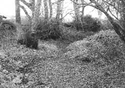
What about streams rising on the PTS? Dover Beck, just to the south of the River Maun, is an example. There is some historical documentation which shows that the stream extended far further up the topographic catchment in the 19th Century than it does today. Nowadays, most of this catchment is dry and current groundwater levels are largely much below the streambed.

There are many similar examples across the Midlands, and these occur where groundwater abstraction has greatly exceeded 50% of the recharge from rainfall. Elsewhere, the impacts of PTS abstraction on surface water are less evident - particularly to the north, where surface watercourses are protected by low-permeability glacial deposits. The absence of glacial deposits over much of the Midlands PTS means that vast quantities of meteoric recharge water can flush through these aquifers.


Present and past hydrological conditions of the Dover Beck catchment

The ‘Dover Beck’ in 1975 Credit: © Environment Agency

Set in stone


The current situation was set in stone by the 1963 Water Resources Act, which required the licensing of most abstractions greater than 10m3/d. However, ‘Licences of Right’ were granted, with no environmental assessment, at rates that were often well in excess of what could actually be pumped from the boreholes.

Did the impacts all go unnoticed before 1970? Well yes, apparently they did - which highlights the key point I wish to make. The PTS is simply a fantastic aquifer, albeit a bit misunderstood in the past. It has withstood the burden of this abstraction, and shown little visible impact. This is the hallmark of an aquifer with a large amount of storage, where the hydraulic signal moves very slowly. The impacts have occurred, but imperceptibly over decades - something you can only really pick up with systematic hydrometric monitoring and sophisticated analysis (particularly using numerical groundwater models).

Of course, some people suspected something was amiss and complained to the authorities; but alas they could be easily fobbed off with bogus explanations involving unusual weather conditions. At the time, the water authorities, in their role as both regulator and water supplier, had little incentive to reverse the situation. Groundwater supply was cheap as it then required little treatment and was close to the demand that was ever increasing. As most monitoring only began after about 1970, for many watercourses it was too late and they, together with their dependent habitats, quietly disappeared - possibly for ever.

By the early 1970s, as water demand was predicted to increase, there was a lot of pressure to increase groundwater abstraction even further. Professional hydrogeologists had begun to appreciate the impacts of constant-rate abstraction, and began to consider different ways of using the aquifers - leading to the development of ‘conjunctive use’ schemes. These combine surface water and groundwater use: the former used during wet periods, and the latter during dry ones when surface water flows are low. Long-term impacts on surface water from groundwater abstraction are thereby much reduced, as groundwater is only used when surface water sources cannot supply during dry periods. The Shropshire Groundwater Scheme (SGS), the largest and one of the best conjunctive use schemes in the UK, takes water from the PTS and is currently operated by the Environment Agency. The reason it works so well is because of the storage capacity of the PTS.


Shropshire Groundwater Scheme, in phased development since 1984 Credit: © Environment Agency

Notable exception


But sadly the SGS is a notable exception. Many other schemes never got past the investigation stage. The Nottingham conjunctive use scheme was planned to alleviate surface water conditions on the East Midlands aquifer, by combining groundwater use with use of water from the River Derwent. However, conservative attitudes among water supply engineers and real concerns about the impacts of the differing quality of surface water and groundwater mixing in the water supply system meant that this scheme was never adopted.

The advent of the National Rivers Authority (NRA) in 1989 saw the split of regulator and water undertaker. The NRA immediately took measures to reduce licences and abstraction, particularly in heavily stressed PTS aquifers such as East Midlands. Progress has been modest, because of the limited powers of the NRA and Environment Agency, its successor organisation, to revoke the old Licences of Right. This was highlighted at the turn of the Millennium by the introduction of the Water Framework Directive (WFD) by the EU and the Catchment Abstraction Management Strategies (CAMS) by the Environment Agency. The latter consigned any traces of previous resource assessments done by the old water authorities to the dustbin for good.

Current levels of abstraction are now much greater than the resource assessment - the real legacy of the 1963 Water Resources Act. It is no surprise that almost all PTS groundwater bodies in the Midlands Region have ‘poor quantitative status’ and are at risk of failure for 2027, the target date currently for ‘good status’ for the WFD. It sounds pretty desperate, as demand is still predicted to increase. This has raised the stakes considerably, as we now have either to tackle this problem, or do some careful explaining, or face infraction proceedings from the EU.


Predictions for flow improvements of the Dover Beck at Lowdham

Climate change


So what about climate change? As Mike Price discussed, current predictions generally say that evapotranspiration will increase in summers, while both total rainfall and rainfall intensity will increase in winters, with increased variability. The balance between the first three factors generally amounts to “less recharge”; although there are some differences in predictions. As a percentage, the impact on groundwater discharge to surface watercourses will be several times greater on the hard-pressed watercourses on the PTS aquifer outcrop, because groundwater abstraction will take its share regardless.

Could it be that by tackling the WFD targets we can also adapt to the impact of climate change - a “win-win”? Well, yes; and the likely answer has been known since the 1970s, namely, conjunctive use, coupled with large-scale reduction of the constant rate abstractions . The Midlands boasts quite the best aquifer for such schemes, as the performance of the SGS has already demonstrated. What is more, because of the low diffusivity of the PTS, the predicted variability in the recharge will be smoothed out and groundwater abstraction will remain secure - even during very long droughts. The SGS is under utilised, and there are other opportunities across the Midlands. The Environment Agency is currently changing CAMS policy statements to promote conjunctive use, but it also requires action from the water companies.

The Environment Agency now has large groundwater models, the ideal tools for exploring the options, covering most of the PTS. The 1990s saw a decline in abstraction, partly associated with licence reductions that the Environment Agency and the NRA negotiated with the water companies, and partly with pollution problems, both point source and diffuse (particularly from nitrates). Predictions using groundwater models show that improvements in surface watercourses are occurring slowly, as seen in the Dover Beck. They also show that flows are much below natural levels.

To have any impact on the 2027 WFD deadline we need to get our skates on. But some care is also required as so little is known about the natural state of the catchments as land use (and sometimes the physical characteristics of the aquifer itself) have changed with time. For example, the Dover Beck catchment has suffered from extensive subsidence associated with coal extraction from the concealed fields beneath the PTS. Local inundation is already a problem on the Dover Beck and this also threatens existing habitats. In other cases urban expansion has covered dry headwaters of catchments.

So, time and care are needed to prevent unwanted inundation, with incremental reductions in groundwater abstraction, careful monitoring and reassessment of our predictive models and their underlying conceptual models. As outcomes will not be immediate, this requires a sustained level of engagement across water companies, regulators and government. That is a real challenge for us geoscientists, while not forgetting the other problem - diffuse pollution.

Further reading

  • Environment Agency, 2006. The State of Groundwater in England and Wales. Environment Agency, Bristol.
  • Mather, J.D., 2004. 200 Years of British Hydrogeology. Geological Society Special Publication 225.
  • Price, M., 1998. Water storage and climate change in Great Britain – the role of groundwater. Proc. Instn. Civ. Engrs. Wat., Marit. & Energy, 130, 42-50.
  • Price, M., 2008. The wrong sort of rain. Geoscientist 18.2, 22-26.
  • Skinner, A.C., 2008. Groundwater: still out of sight but less out of mind. Quarterly Journal of Engineering Geology and Hydrogeology, 41, 5-19.
  • Shepley, M.G., Pearson, A.D., Smith, G.D. & Banton, C.J., 2008. The impacts of coal mining subsidence on groundwater resources management of the East Midlands Permo-Triassic Sandstone aquifer, England. Quarterly Journal of Engineering Geology and Hydrogeology, 41, 5-19.
* Environment Agency, Midlands Region, Solihull, United Kingdom

Acknowledgments


The author thanks John Aldrick, Mike Price and Andrew Skinner for comments on the article and Dick Downing for a useful discussion on the 1963 Water Resources Act. Some of the photos and figures have been provided by Kevin Voyce, Alastair Black and The Friends of The Bratch. The views expressed in this article are those of the author and not necessarily those of the hydrogeologists acknowledged above or the Environment Agency.